
File:Bad Dürkheim Luitpoldweg 1 001 2012 06 10.jpg
Original file (2,914 × 1,715 pixels, file size: 1.91 MB, MIME type: image/jpeg)
Captions
Captions
Summary
[edit]
| Description |
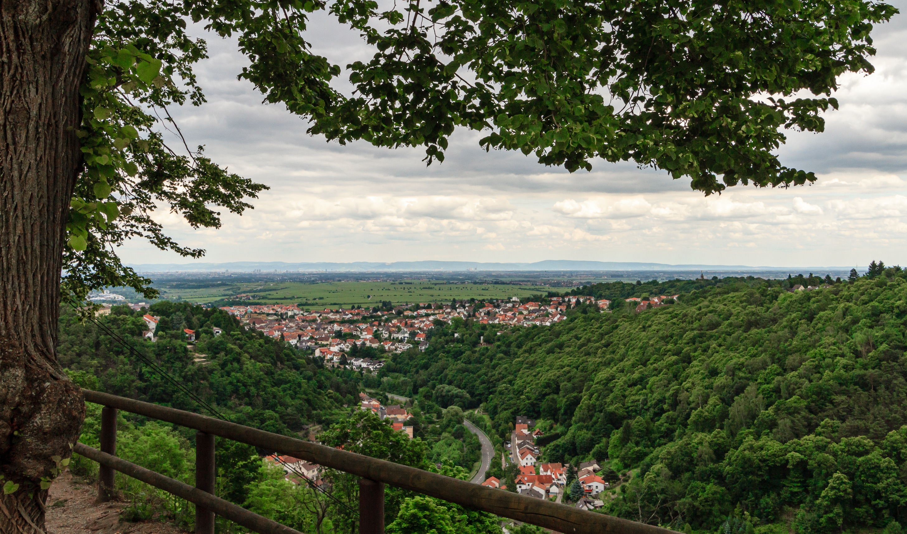
Title: View from Limburg Abbey to the east at quarter Seebach (Bad Dürkheim) and the Rhine Rift Valley
Designation 1: Palatinate Forest Nature Park - Development zone
Designation 2: Biosphere reserve Palatinate Forest
Designation 3: Haardtrand - Am Limburgberg |
||||||
| Date | Taken on 10.06.2012 14:01:32 | ||||||
| Source | Self-photographed | ||||||
| Author | Friedrich Haag | ||||||
| Attribution (required by the license) | © Friedrich Haag / Wikimedia Commons / | ||||||
| Object location | | View this and other nearby images on: OpenStreetMap |
|---|
| Camera location | | View this and other nearby images on: OpenStreetMap |
|---|
Licensing
[edit]
- You are free:
- to share – to copy, distribute and transmit the work
- to remix – to adapt the work
- Under the following conditions:
- attribution – You must give appropriate credit, provide a link to the license, and indicate if changes were made. You may do so in any reasonable manner, but not in any way that suggests the licensor endorses you or your use.
- share alike – If you remix, transform, or build upon the material, you must distribute your contributions under the same or compatible license as the original.
Assessment
[edit]
This image has been assessed using the Quality image guidelines and is considered a Quality image.
|
File history
Click on a date/time to view the file as it appeared at that time.
| Date/Time | Thumbnail | Dimensions | User | Comment | |
|---|---|---|---|---|---|
| current | 17:24, 21 October 2020 | | 2,914 × 1,715 (1.91 MB) | F. Riedelio (talk | contribs) | Uploaded with LrMediaWiki 0.8.0, LR 9.4 Win |
You cannot overwrite this file.
File usage on Commons
The following 9 pages use this file:
- User:F. Riedelio/Fotowettbewerbe/2020
- User:F. Riedelio/Geschützte Gebiete und Objekte/Deutschland/Rheinland-Pfalz
- User:F. Riedelio/Quality Image Promotion/2021/2021 1
- User:F. Riedelio/Wiki Loves Earth chronologisch/No WLE/2020
- Commons:Photo challenge/2020 - October - Long distance views
- Commons:Photo challenge/2020 - October - Long distance views/Voting
- Commons:Photo challenge/2020 - October - Long distance views/Voting/Result
- Commons:Quality images/Subject/Places/Mixed/Archive4
- Commons:Quality images candidates/Archives April 01 2021