File:20200709 Schanzenbergbrücke 01.jpg

Original file (6,016 × 4,016 pixels, file size: 18.27 MB, MIME type: image/jpeg)
Captions
Captions
Summary
[edit]Description20200709 Schanzenbergbrücke 01.jpg |
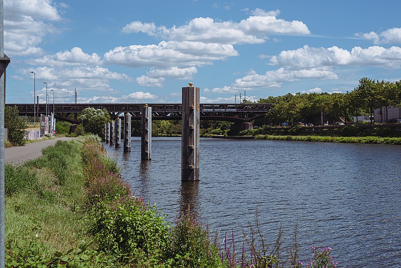
Deutsch: Blick auf die Schanzenbergbrücke von dem Fußweg zwischen dem Ufer der Saar und der Saarstahlwerke in Burbach aus. Vor der Brücke befindet sich eine Schiffsanlegestelle.
English: View on the Schanzenberg-Bridge from a footpath between the shore of the Saar and the Burbach iron works. In front of the bridge is a pier. |
Date | Taken on 9 July 2020, 14:13:17 |
Source | Own work |
Author | Flocci Nivis |
Camera location | 49° 14′ 03.52″ N, 6° 57′ 28.84″ E ![]() | View this and other nearby images on: OpenStreetMap | ![]() |
---|
Licensing
[edit]

- You are free:
- to share – to copy, distribute and transmit the work
- to remix – to adapt the work
- Under the following conditions:
- attribution – You must give appropriate credit, provide a link to the license, and indicate if changes were made. You may do so in any reasonable manner, but not in any way that suggests the licensor endorses you or your use.
![]() |
This image has been assessed using the Quality image guidelines and is considered a Quality image.
العربية ∙ جازايرية ∙ беларуская ∙ беларуская (тарашкевіца) ∙ български ∙ বাংলা ∙ català ∙ čeština ∙ Cymraeg ∙ Deutsch ∙ Schweizer Hochdeutsch ∙ Zazaki ∙ Ελληνικά ∙ English ∙ Esperanto ∙ español ∙ eesti ∙ euskara ∙ فارسی ∙ suomi ∙ français ∙ galego ∙ עברית ∙ हिन्दी ∙ hrvatski ∙ magyar ∙ հայերեն ∙ Bahasa Indonesia ∙ italiano ∙ 日本語 ∙ Jawa ∙ ქართული ∙ Qaraqalpaqsha ∙ 한국어 ∙ kurdî ∙ кыргызча ∙ Latina ∙ Lëtzebuergesch ∙ lietuvių ∙ македонски ∙ മലയാളം ∙ मराठी ∙ Bahasa Melayu ∙ Nederlands ∙ Norfuk / Pitkern ∙ polski ∙ português ∙ português do Brasil ∙ rumantsch ∙ română ∙ русский ∙ sicilianu ∙ slovenčina ∙ slovenščina ∙ shqip ∙ српски / srpski ∙ svenska ∙ தமிழ் ∙ తెలుగు ∙ ไทย ∙ Tagalog ∙ toki pona ∙ Türkçe ∙ українська ∙ oʻzbekcha / ўзбекча ∙ vèneto ∙ Tiếng Việt ∙ 中文 ∙ 中文(简体) ∙ 中文(繁體) ∙ +/− |
File history
Click on a date/time to view the file as it appeared at that time.
Date/Time | Thumbnail | Dimensions | User | Comment | |
---|---|---|---|---|---|
current | 18:18, 13 November 2022 | ![]() | 6,016 × 4,016 (18.27 MB) | FlocciNivis (talk | contribs) | various editing |
21:59, 30 April 2021 | ![]() | 5,728 × 3,829 (7.5 MB) | FlocciNivis (talk | contribs) | Uploaded own work with UploadWizard |
You cannot overwrite this file.
File usage on Commons
The following 3 pages use this file:
File usage on other wikis
The following other wikis use this file:
- Usage on de.wikipedia.org
Metadata
This file contains additional information such as Exif metadata which may have been added by the digital camera, scanner, or software program used to create or digitize it. If the file has been modified from its original state, some details such as the timestamp may not fully reflect those of the original file. The timestamp is only as accurate as the clock in the camera, and it may be completely wrong.
Camera manufacturer | NIKON CORPORATION |
---|---|
Camera model | NIKON D750 |
Author | David Rasp |
Copyright holder |
|
Exposure time | 1/1,250 sec (0.0008) |
F-number | f/5.6 |
ISO speed rating | 100 |
Date and time of data generation | 14:13, 9 July 2020 |
Lens focal length | 50 mm |
Horizontal resolution | 240 dpi |
Vertical resolution | 240 dpi |
Software used | Adobe Lightroom 6.0 (Windows) |
File change date and time | 19:11, 13 November 2022 |
Exposure Program | Aperture priority |
Exif version | 2.31 |
Date and time of digitizing | 14:13, 9 July 2020 |
APEX shutter speed | 10.287712 |
APEX aperture | 4.970854 |
APEX exposure bias | −0.33333333333333 |
Maximum land aperture | 1.6 APEX (f/1.74) |
Metering mode | Pattern |
Light source | Unknown |
Flash | Flash did not fire, compulsory flash suppression |
DateTimeOriginal subseconds | 29 |
DateTimeDigitized subseconds | 29 |
Color space | sRGB |
Focal plane X resolution | 1,675.0149841309 |
Focal plane Y resolution | 1,675.0149841309 |
Focal plane resolution unit | 3 |
Sensing method | One-chip color area sensor |
File source | Digital still camera |
Scene type | A directly photographed image |
Custom image processing | Normal process |
Exposure mode | Auto exposure |
White balance | Auto white balance |
Digital zoom ratio | 1 |
Focal length in 35 mm film | 50 mm |
Scene capture type | Standard |
Scene control | None |
Contrast | Normal |
Saturation | Normal |
Sharpness | Normal |
Subject distance range | Unknown |
Serial number of camera | 6088139 |
Lens used | 50.0 mm f/1.8 |
Date metadata was last modified | 20:11, 13 November 2022 |
Unique ID of original document | D21C827E8427C01F96255883C9096B31 |
IIM version | 4 |
Structured data
Items portrayed in this file
depicts
9 July 2020
49°14'3.52"N, 6°57'28.84"E
0.0008 second
5.6
50 millimetre
100
image/jpeg
95208b22785a40e15087db411203960515e4c887
19,156,559 byte
4,016 pixel
6,016 pixel
- Saarbrücken photographs taken on 2020-07-09
- Files with coordinates missing SDC location of creation (49° N, 6° E)
- CC-BY-4.0
- Self-published work
- Quality images by User:FlocciNivis
- Quality images of Saarbrücken
- Quality images of bridges in Germany
- Quality images
- Quality images of piers in Germany
- Images by User:FlocciNivis