
File:Étang de Thau, Sète, Hérault 02.jpg

Size of this preview: 800 × 500 pixels. Other resolutions: 320 × 200 pixels | 640 × 400 pixels | 1,024 × 640 pixels | 1,280 × 800 pixels | 2,560 × 1,600 pixels | 4,280 × 2,675 pixels.
Original file (4,280 × 2,675 pixels, file size: 11.11 MB, MIME type: image/jpeg)
Captions
Captions
Add a one-line explanation of what this file represents
Summary
[edit]
| Description |
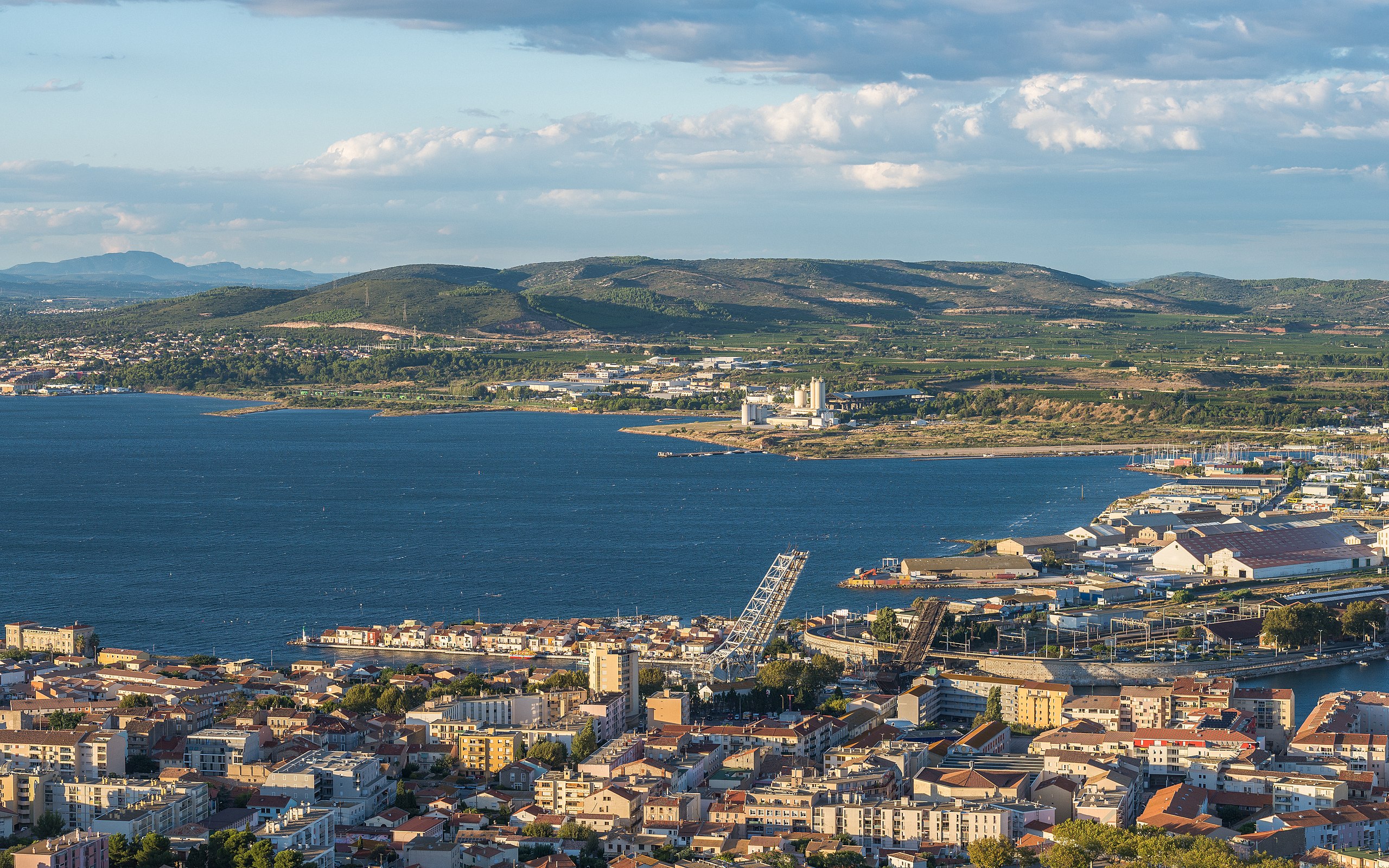
Français : L'extrémité est de l'étang de Thau depuis le mont Saint-Clair à Sète, Hérault, France. Au premier plan, une partie de la ville de Sète avec notamment le quartier de le Pointe Courte, les ponts Maréchal Foch Sadi-Carnot (tous deux des ponts à bascule, ici en position ouverts) au dessus du Canal de Sète et la gare de Sète. Dans le fond sur la droite, une partie de la commune de Frontignan et sur le gauche une partie de celle de Balaruc-les-Bains, et derrière les deux la Montagne de la Gardiole.
English: The Eastern end of the Étang de Thau from the Mount Saint-Clair in Sète, Hérault, France. In the foreground, a part of the town of Sète with the Pointe Courte Neighbourhood, the Maréchal Foch and Sadi-Carnot Bridges (the both are bascule bridges, here in open positions) over the Canal of Sète, and the train station. In background, at right a part of the commune of Frontignan, at left a part of the commune of Balaruc-les-Bains and behind the both the La Gardiole Mountain.
Deutsch: Östliches Ende des Étang de Thau vom Berg Saint-Clair in Sète, Hérault, Frankreich. Im Vordergrund ein Teil der Stadt Sète mit dem Stadtteil Pointe Courte, die beiden Brücken Maréchal Foch und Sadi-Carnot (beides Klappbrücken hier in geöffneter Stellung) über den Canal de Sète und den Bahnhof von Sète. Im Hintergrund rechts ein Teil der Ortschaft Frontignan und links ein Teil von Balaruc-les-Bains, dahinter der Berg Gardiole. |
| Date | Taken on 10 September 2013, 19:22:58 |
| Source | Own work |
| Author | Christian Ferrer |
| Permission (Reusing this file) |
I, the copyright holder of this work, hereby publish it under the following license: This file is licensed under the Creative Commons Attribution-Share Alike 3.0 Unported license.
|
| Camera location | | View this and other nearby images on: OpenStreetMap |
|---|
|

|
This image has been assessed under the valued image criteria and is considered the most valued image on Commons within the scope: Eastern end of the Étang de Thau, Hérault, France. View from Southwest in 2013.. You can see its nomination here. |
File history
Click on a date/time to view the file as it appeared at that time.
| Date/Time | Thumbnail | Dimensions | User | Comment | |
|---|---|---|---|---|---|
| current | 16:30, 29 January 2014 | | 4,280 × 2,675 (11.11 MB) | Christian Ferrer (talk | contribs) | reworked |
| 03:56, 21 September 2013 |  | 5,912 × 3,695 (21.51 MB) | Christian Ferrer (talk | contribs) | noise/sharp | |
| 18:21, 20 September 2013 |  | 5,912 × 3,695 (21.96 MB) | Christian Ferrer (talk | contribs) | colors + contrast | |
| 12:10, 20 September 2013 |  | 5,912 × 3,695 (20.48 MB) | Christian Ferrer (talk | contribs) | User created page with UploadWizard |
You cannot overwrite this file.
File usage on Commons
The following 25 pages use this file:
- Sète
- Étang de Thau
- User:Bennylin/Cityscapes
- User:Beria/POTY per date
- User:Miya/POTY/2014
- User:Ö/Best/2014
- User talk:Christian Ferrer/Archive3
- User talk:Christian Ferrer/Archive5
- Commons:Featured picture candidates/File:Étang de Thau, Sète, Hérault 02.jpg
- Commons:Featured picture candidates/Log/February 2014
- Commons:Featured pictures/Places/Architecture/Cityscapes
- Commons:Featured pictures/chronological/2014-A
- Commons:Picture of the Year/2014/Candidates
- Commons:Picture of the Year/2014/R1/Gallery/2014-A
- Commons:Picture of the Year/2014/R1/Gallery/ALL
- Commons:Picture of the Year/2014/R1/Gallery/M02
- Commons:Picture of the Year/2014/R1/Gallery/Settlements
- Commons:Picture of the Year/2014/R1/Results/Candidates
- Commons:Picture of the Year/2014/R1/Results/Candidates/Settlements
- Commons:Picture of the Year/2014/R1/Results/Settlements
- Commons:Picture of the Year/2014/R1/v/Étang de Thau, Sète, Hérault 02.jpg
- Commons:Quality images/Subject/Places/Mixed/Archive1
- Commons:Quality images candidates/Archives September 23 2013
- Commons:Valued image candidates/Étang de Thau, Sète, Hérault 02.jpg
- Commons:Valued images by topic/Places/Natural/Rivers and lakes
File usage on other wikis
The following other wikis use this file:
- Usage on ceb.wikipedia.org
- Usage on cs.wikipedia.org
- Usage on de.wikipedia.org
- Usage on en.wikipedia.org
- Usage on fr.wikipedia.org
- Usage on io.wikipedia.org
- Usage on mg.wikipedia.org
- Usage on sl.wikipedia.org
- Usage on www.wikidata.org
- Usage on zh.wikipedia.org