
File:View from Litlefjellet at Romsdalen, 2013 June.jpg
Size of this preview: 800 × 365 pixels. Other resolutions: 320 × 146 pixels | 640 × 292 pixels | 1,024 × 467 pixels | 1,280 × 584 pixels | 2,560 × 1,167 pixels | 6,580 × 3,000 pixels.
Original file (6,580 × 3,000 pixels, file size: 18.5 MB, MIME type: image/jpeg)
Captions
Captions
Add a one-line explanation of what this file represents
Summary
[edit]
| Description |
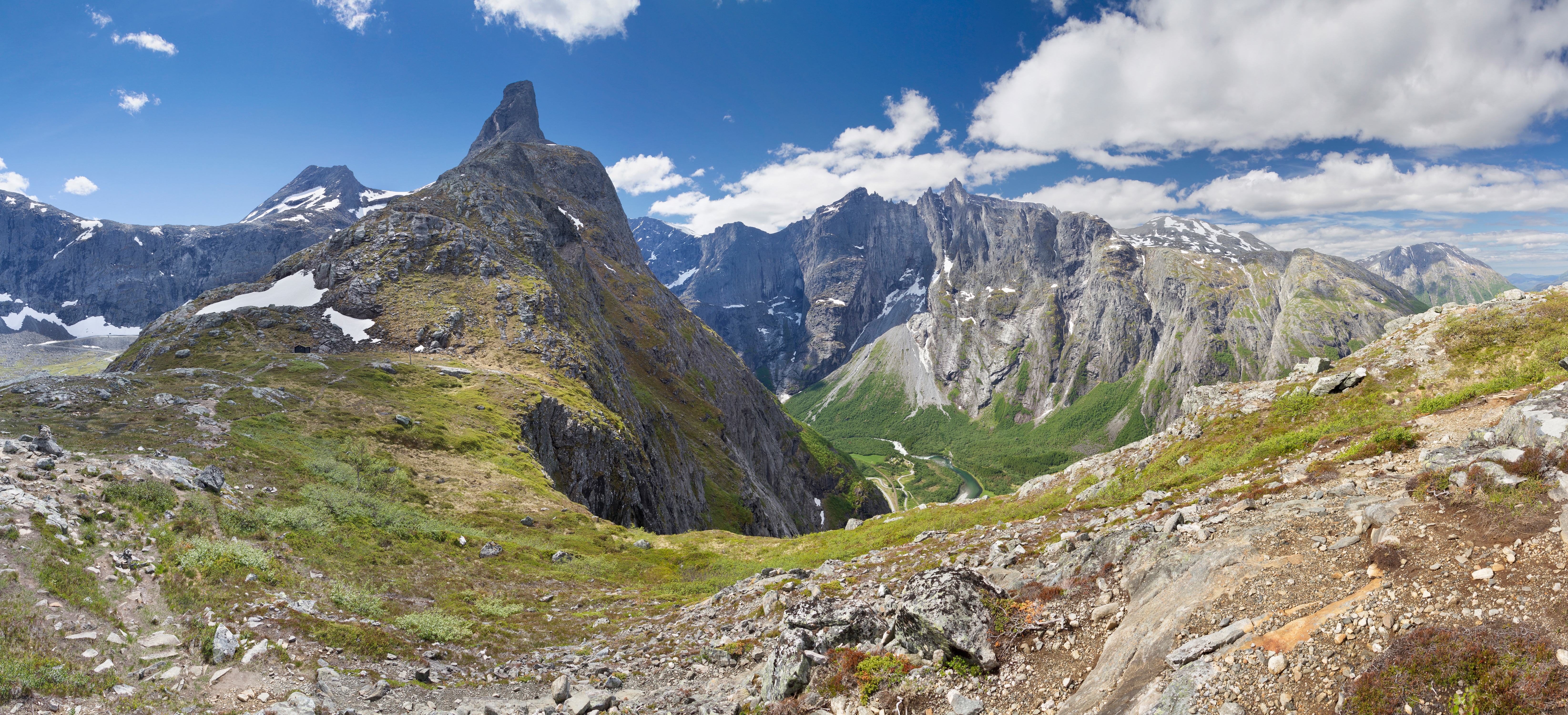
English: A view towards Romsdalen and Romsdalshornet from the Litlefjellet ridge between Romsdalen and Vengedalen, Møre og Romsdal, Norway in 2013 June. Trolltindane mountain range with its famous vertical rock face Trollveggen is on the other side of the valley. |
| Date | |
| Source | Own work |
| Author | Ximonic (Simo Räsänen) |
| Camera location | | View this and other nearby images on: OpenStreetMap |
|---|

|
NOTE: This image is a panorama consisting of multiple frames that were merged or stitched in software using a cylindrical projection. As a result, this image necessarily underwent some form of digital manipulation. These manipulations may include blending, blurring, cloning, and colour and perspective adjustments. As a result of these adjustments, the image content may be slightly different from reality at the points where multiple images were combined. This manipulation is often required due to lens, perspective, and parallax distortions.
|
Licensing
[edit]
I, the copyright holder of this work, hereby publish it under the following license:
This file is licensed under the Creative Commons Attribution-Share Alike 3.0 Unported license.
- You are free:
- to share – to copy, distribute and transmit the work
- to remix – to adapt the work
- Under the following conditions:
- attribution – You must give appropriate credit, provide a link to the license, and indicate if changes were made. You may do so in any reasonable manner, but not in any way that suggests the licensor endorses you or your use.
- share alike – If you remix, transform, or build upon the material, you must distribute your contributions under the same or compatible license as the original.
| Annotations | This image is annotated: View the annotations at Commons |
This image has been assessed using the Quality image guidelines and is considered a Quality image.
|
File history
Click on a date/time to view the file as it appeared at that time.
| Date/Time | Thumbnail | Dimensions | User | Comment | |
|---|---|---|---|---|---|
| current | 15:09, 29 September 2016 | | 6,580 × 3,000 (18.5 MB) | Ximonic (talk | contribs) | sRGB |
| 14:45, 27 July 2013 |  | 6,580 × 3,000 (17.62 MB) | Ximonic (talk | contribs) | User created page with UploadWizard |
You cannot overwrite this file.
File usage on Commons
The following 9 pages use this file:
- Hiking in Norway
- Hiking in the Nordic countries
- User:Ximonic
- User:Ximonic/Gallery/Norway/Møre og Romsdal
- User talk:Ximonic/Archive/2013
- Commons:Featured picture candidates/File:View to Romsdalen from Litlefjellet, 2013 June.jpg
- Commons:Featured picture candidates/Log/August 2013
- Commons:Quality images/Subject/Places/Natural structures/archive 2013 to 2014
- Commons:Quality images candidates/Archives July 31 2013
File usage on other wikis
The following other wikis use this file:
- Usage on en.wikipedia.org
- Usage on fi.wikipedia.org
- Usage on hu.wikipedia.org