
File:Val Gardena with Sella and Saslonch from Resciesa.JPG

Size of this preview: 800 × 534 pixels. Other resolutions: 320 × 214 pixels | 640 × 427 pixels | 1,024 × 683 pixels | 1,280 × 854 pixels | 2,560 × 1,709 pixels | 7,360 × 4,912 pixels.
Original file (7,360 × 4,912 pixels, file size: 18.21 MB, MIME type: image/jpeg)
Captions
Captions
Add a one-line explanation of what this file represents
Summary
[edit]| Description | |||||||
| Date | |||||||
| Source | Own work | ||||||
| Author |
|
||||||
| Other versions |


| Camera location | | View this and other nearby images on: OpenStreetMap |
|---|
Licensing
[edit]
I, the copyright holder of this work, hereby publish it under the following licenses:
This file is licensed under the Creative Commons Attribution-Share Alike 3.0 Unported license.
- You are free:
- to share – to copy, distribute and transmit the work
- to remix – to adapt the work
- Under the following conditions:
- attribution – You must give appropriate credit, provide a link to the license, and indicate if changes were made. You may do so in any reasonable manner, but not in any way that suggests the licensor endorses you or your use.
- share alike – If you remix, transform, or build upon the material, you must distribute your contributions under the same or compatible license as the original.

|
Permission is granted to copy, distribute and/or modify this document under the terms of the GNU Free Documentation License, Version 1.2 or any later version published by the Free Software Foundation; with no Invariant Sections, no Front-Cover Texts, and no Back-Cover Texts. A copy of the license is included in the section entitled GNU Free Documentation License. |
You may select the license of your choice.
| Annotations | This image is annotated: View the annotations at Commons |
This image has been assessed using the Quality image guidelines and is considered a Quality image.
|
File history
Click on a date/time to view the file as it appeared at that time.
| Date/Time | Thumbnail | Dimensions | User | Comment | |
|---|---|---|---|---|---|
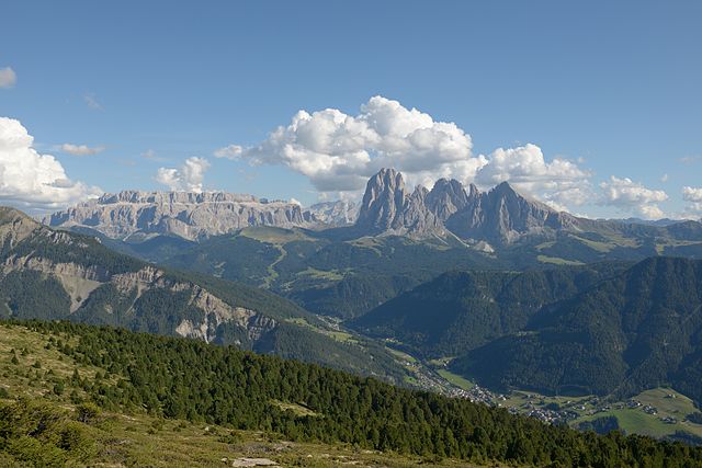
| current | 11:31, 7 September 2012 | | 7,360 × 4,912 (18.21 MB) | Moroder (talk | contribs) | == {{int:filedesc}} == {{Information |Description= {{en|1=Val Gardena with the Saslonch and Sella group in the Dolomites from Resciesa, South Tyrol}} |Source={{Own}} |Author={{User:Moroder/Template:Credits}} |Date=2012-08-29 |Permis... |
You cannot overwrite this file.
File usage on Commons
The following 9 pages use this file:
- Dolomiti
- Gröden
- Langkofelgruppe
- User:Moroder
- User talk:Moroder/Archives 2012-3
- Commons:Quality images/Subject/Places/Natural structures/archive 2008 to 2012
- Commons:Quality images candidates/Archives September 2012
- File:Sella, Langkofel, Sellajoch.JPG
- File:Val Gardena with Sella and Saslonch from Resciesa.JPG
File usage on other wikis
The following other wikis use this file:
- Usage on bn.wikipedia.org
- Usage on da.wikipedia.org
- Usage on de.wikipedia.org
- Usage on en.wikipedia.org
- Usage on es.wikipedia.org
- Usage on he.wikivoyage.org
- Usage on hu.wikipedia.org
- Usage on it.wikiversity.org
- Usage on lld.wikipedia.org
- Usage on rm.wikipedia.org
- Usage on sr.wikipedia.org
- Usage on vi.wikipedia.org
- Usage on vls.wikipedia.org
- Usage on war.wikipedia.org