
File:Speicher Zillergründl 01.JPG

Size of this preview: 800 × 531 pixels. Other resolutions: 320 × 213 pixels | 640 × 425 pixels | 1,024 × 680 pixels | 1,280 × 850 pixels | 2,560 × 1,700 pixels | 4,288 × 2,848 pixels.
Original file (4,288 × 2,848 pixels, file size: 3.64 MB, MIME type: image/jpeg)
Captions
Captions
Add a one-line explanation of what this file represents
| Description |
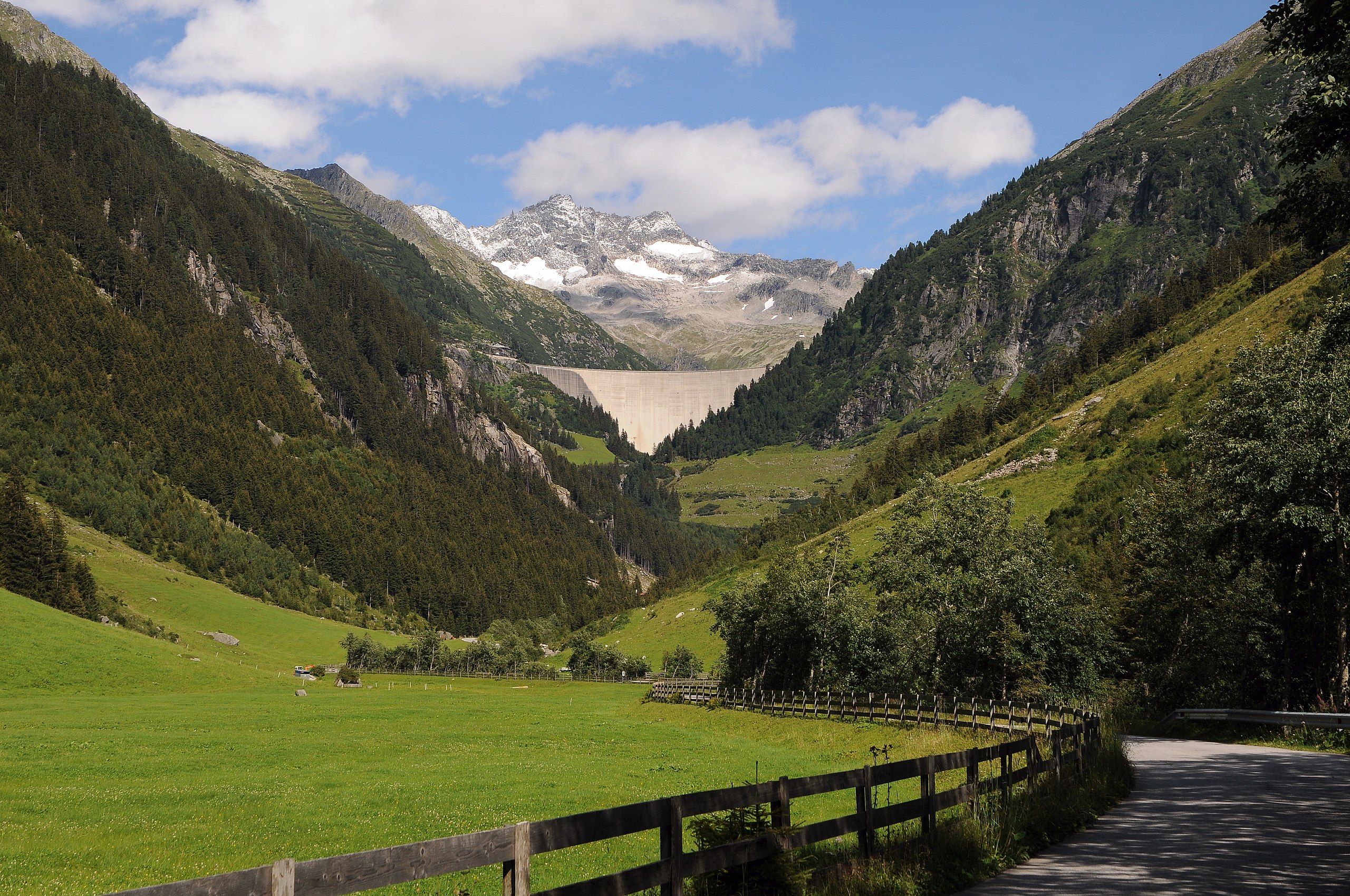
Deutsch: 1980 wurde mit dem Bau der Sperre Zillergründl begonnen. Das Sperrwerk ist als doppeltgekrümmte Bogengewichtsmauer ausgeführt. Das Wasser des Speichers fließt durch einen 8,6 Kilometer langen Triebwasserstollen zum Kraftwerk Häusling und nach der Stromerzeugung durch einen 7,8 Kilometer langen Stollen weiter zum Speicher Stillup. Erreichbar ist der Speichersee über eine 18 km lange Mautstraße, die für den öffentlichen Verkehr ab dem Gasthof Bärenbad (km 14) gesperrt ist, von hier aus ist die Staumauer nur mit dem Bus oder Rad (durch 2 Tunnels) erreichbar (km 18). Ansicht von Westen. Über dem rechten Ende der Staumauer die Plauener Hütte, dahinter die Westseite der Reichenspitzgruppe mit (v.l.n.r) Gamsscharte (2972m), Finger (markante Felsformation), Nördlicher Schwarzkopf (3082m/3079m), Südlicher Schwarzkopf (3045m/3042m). |
||
| Date | |||
| Source | Own work | ||
| Author |
|
||
| Permission (Reusing this file) |
I, the copyright holder of this work, hereby publish it under the following licenses:
This file is licensed under the Creative Commons Attribution-Share Alike 3.0 Austria license.
 You may select the license of your choice. |

| Camera location | | View this and other nearby images on: OpenStreetMap |
|---|
This image has been assessed using the Quality image guidelines and is considered a Quality image.
|
File history
Click on a date/time to view the file as it appeared at that time.
| Date/Time | Thumbnail | Dimensions | User | Comment | |
|---|---|---|---|---|---|
| current | 20:32, 30 January 2013 | | 4,288 × 2,848 (3.64 MB) | Böhringer (talk | contribs) | {{Information |Description= {{de|1980 wurde mit dem Bau der Sperre Zillergründl begonnen. Das Sperrwerk ist als doppeltgekrümmte Bogengewichtsmauer ausgeführt. Das Wasser des Speichers flie... |
You cannot overwrite this file.
File usage on Commons
The following 11 pages use this file:
- User:Böhringer/Archive 5
- Commons:Quality images/Subject/Places/Mixed/Archive1
- Commons:Quality images candidates/Archives August 24 2013
- File:Speicher Zillergründl 02.jpg
- File:Speicher Zillergründl 03.jpg
- File:Speicher Zillergründl 04.jpg
- File:Speicher Zillergründl 05.jpg
- File:Speicher Zillergründl 06.jpg
- File:Speicher Zillergründl 07.jpg
- File:Speicher Zillergründl 08.jpg
- Category:Zillergrund
File usage on other wikis
The following other wikis use this file:
- Usage on ceb.wikipedia.org
- Usage on de.wikipedia.org
- Usage on www.wikidata.org