File:Sluice near Malé Leváre.jpg

Original file (4,928 × 3,264 pixels, file size: 6.01 MB, MIME type: image/jpeg)
Captions
Captions
Summary
[edit]DescriptionSluice near Malé Leváre.jpg |
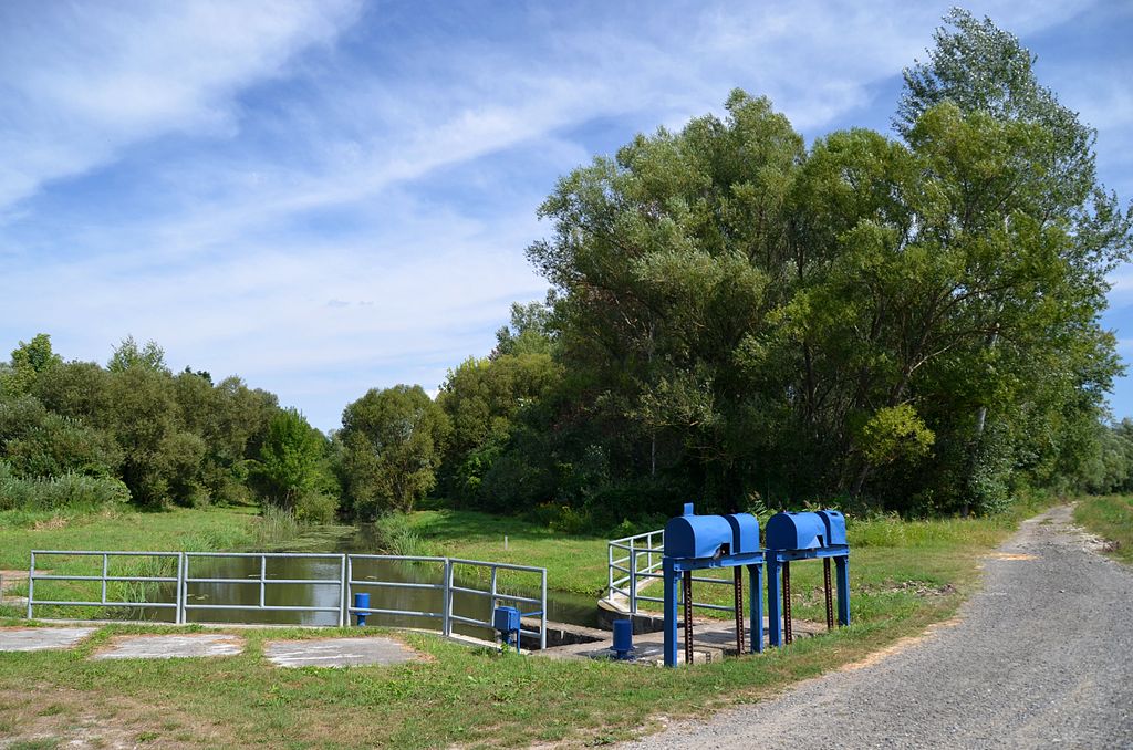
English: Irrigation sluice near Malé Leváre, Slovakia. This is in the floodplains of the Morava river. Deutsch: Bewässerungsschleuse in den Marchauen in der Slowakei, nahe der Gemeinde Malé Leváre. Über den Schotterweg führt der EuroVelo 13 an dieser Stelle. |
Date | |
Source | Own work |
Author | Herzi Pinki |
Camera location | 48° 29′ 58.19″ N, 16° 56′ 17.48″ E ![]() | View this and other nearby images on: OpenStreetMap | ![]() |
---|
Licensing
[edit]


- You are free:
- to share – to copy, distribute and transmit the work
- to remix – to adapt the work
- Under the following conditions:
- attribution – You must give appropriate credit, provide a link to the license, and indicate if changes were made. You may do so in any reasonable manner, but not in any way that suggests the licensor endorses you or your use.
- share alike – If you remix, transform, or build upon the material, you must distribute your contributions under the same or compatible license as the original.
![]() |
This image has been assessed using the Quality image guidelines and is considered a Quality image.
العربية ∙ جازايرية ∙ беларуская ∙ беларуская (тарашкевіца) ∙ български ∙ বাংলা ∙ català ∙ čeština ∙ Cymraeg ∙ Deutsch ∙ Schweizer Hochdeutsch ∙ Zazaki ∙ Ελληνικά ∙ English ∙ Esperanto ∙ español ∙ eesti ∙ euskara ∙ فارسی ∙ suomi ∙ français ∙ galego ∙ עברית ∙ हिन्दी ∙ hrvatski ∙ magyar ∙ հայերեն ∙ Bahasa Indonesia ∙ italiano ∙ 日本語 ∙ Jawa ∙ ქართული ∙ Qaraqalpaqsha ∙ 한국어 ∙ kurdî ∙ кыргызча ∙ Latina ∙ Lëtzebuergesch ∙ lietuvių ∙ македонски ∙ മലയാളം ∙ मराठी ∙ Bahasa Melayu ∙ Nederlands ∙ Norfuk / Pitkern ∙ polski ∙ português ∙ português do Brasil ∙ rumantsch ∙ română ∙ русский ∙ sicilianu ∙ slovenčina ∙ slovenščina ∙ shqip ∙ српски / srpski ∙ svenska ∙ தமிழ் ∙ తెలుగు ∙ ไทย ∙ Tagalog ∙ toki pona ∙ Türkçe ∙ українська ∙ oʻzbekcha / ўзбекча ∙ vèneto ∙ Tiếng Việt ∙ 中文 ∙ 中文(简体) ∙ 中文(繁體) ∙ +/− |
File history
Click on a date/time to view the file as it appeared at that time.
Date/Time | Thumbnail | Dimensions | User | Comment | |
---|---|---|---|---|---|
current | 22:18, 11 November 2012 | ![]() | 4,928 × 3,264 (6.01 MB) | Herzi Pinki (talk | contribs) | User created page with UploadWizard |
You cannot overwrite this file.
File usage on Commons
The following 2 pages use this file:
File usage on other wikis
The following other wikis use this file:
- Usage on hu.wikipedia.org
Metadata
This file contains additional information such as Exif metadata which may have been added by the digital camera, scanner, or software program used to create or digitize it. If the file has been modified from its original state, some details such as the timestamp may not fully reflect those of the original file. The timestamp is only as accurate as the clock in the camera, and it may be completely wrong.
Camera manufacturer | NIKON CORPORATION |
---|---|
Camera model | NIKON D7000 |
Author | Christian Philipp |
Copyright holder |
|
Exposure time | 1/250 sec (0.004) |
F-number | f/5 |
ISO speed rating | 160 |
Date and time of data generation | 12:19, 30 August 2012 |
Lens focal length | 18 mm |
Latitude | 48° 29′ 58.19″ N |
Longitude | 16° 56′ 17.48″ E |
Altitude | 157 meters above sea level |
Usage terms |
|
Label | Blau |
Orientation | Normal |
Horizontal resolution | 72 dpi |
Vertical resolution | 72 dpi |
Software used | ViewNX 2.0 M |
File change date and time | 20:55, 11 November 2012 |
Y and C positioning | Centered |
Exposure Program | Shutter priority |
Exif version | 2.3 |
Date and time of digitizing | 12:19, 30 August 2012 |
Meaning of each component |
|
APEX exposure bias | −0.33333333333333 |
Maximum land aperture | 3.6 APEX (f/3.48) |
Metering mode | Pattern |
Light source | Unknown |
Flash | Flash did not fire, compulsory flash suppression |
DateTime subseconds | 00 |
DateTimeOriginal subseconds | 00 |
DateTimeDigitized subseconds | 00 |
Supported Flashpix version | 1 |
Color space | sRGB |
Sensing method | One-chip color area sensor |
File source | Digital still camera |
Scene type | A directly photographed image |
Custom image processing | Normal process |
Exposure mode | Auto exposure |
White balance | Auto white balance |
Digital zoom ratio | 1 |
Focal length in 35 mm film | 27 mm |
Scene capture type | Standard |
Scene control | None |
Contrast | Normal |
Saturation | Normal |
Sharpness | Normal |
Subject distance range | Unknown |
GPS time (atomic clock) | 10:19 |
Satellites used for measurement | 04 |
Geodetic survey data used | WGS 84 |
GPS date | 30 August 2012 |
GPS tag version | 2.3.0.0 |
Urgency | Low (6) |