File:PL-DS, pow. trzebnicki, gm. Oborniki Śląskie, Bagno; Zespół pałacowy, ob. klasztor salwatorianów- pałac (jadalnia); A-3912-1203.jpg

Original file (5,616 × 3,744 pixels, file size: 15.92 MB, MIME type: image/jpeg)
Captions
Captions
Summary
[edit]DescriptionPL-DS, pow. trzebnicki, gm. Oborniki Śląskie, Bagno; Zespół pałacowy, ob. klasztor salwatorianów- pałac (jadalnia); A-3912-1203.jpg |
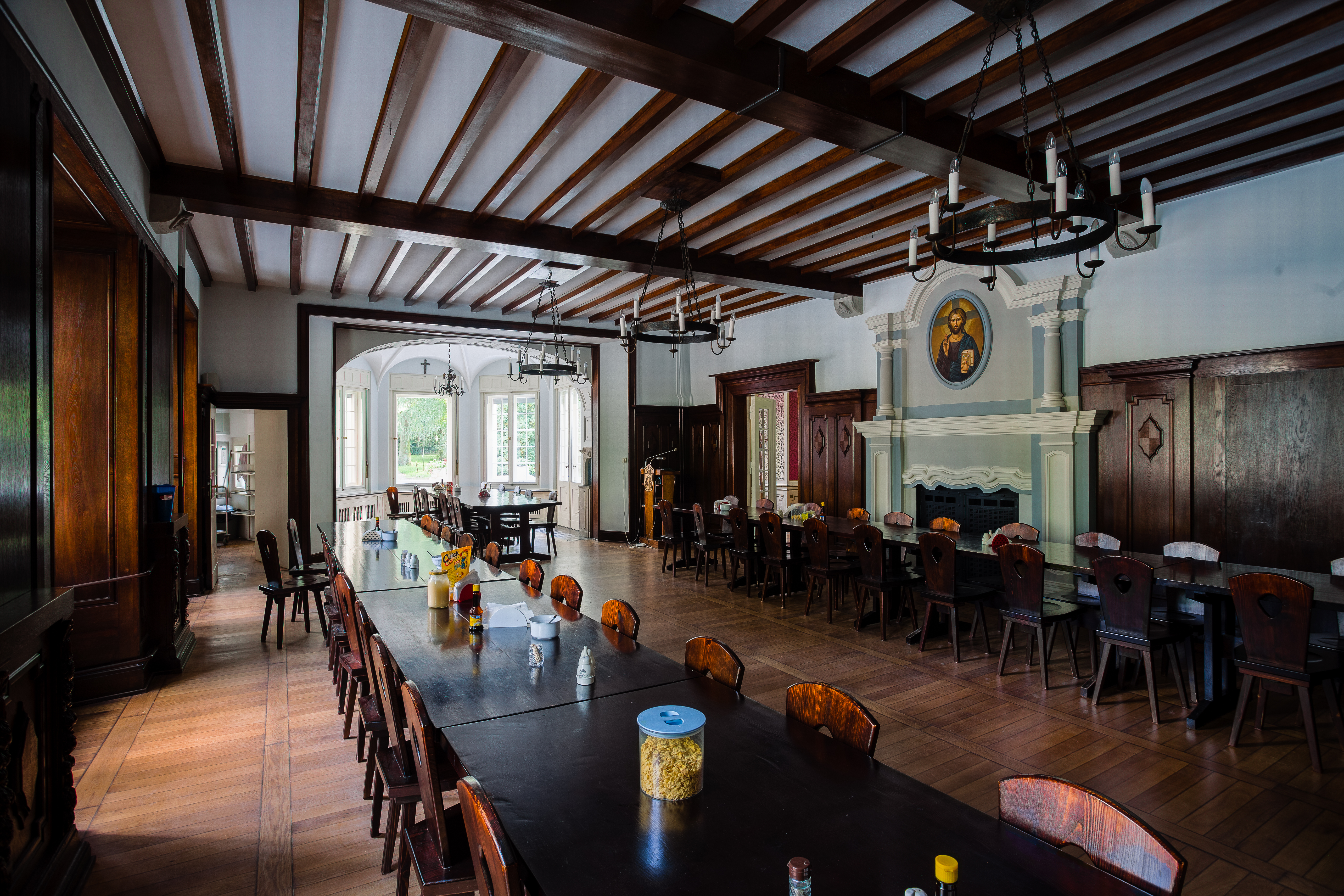
Polski: Zespół pałacowy, ob. klasztor salwatorianów: pałac (jadalnia)
English: The palace complex (now the Salvatorians monastery): palace (dining room) |
Date | |
Source | Own work |
Author | Kriskros |
Permission (Reusing this file) |
I, the copyright holder of this work, hereby publish it under the following license: ![]() ![]() ![]() This file is licensed under the Creative Commons Attribution-Share Alike 3.0 Poland license.
![]() |
Camera location | 51° 20′ 13.2″ N, 16° 49′ 02.38″ E ![]() | View this and other nearby images on: OpenStreetMap | ![]() |
---|
![]() |
This image was uploaded as part of Wiki Loves Monuments 2012.
Afrikaans ∙ Alemannisch ∙ العربية ∙ جازايرية ∙ azərbaycanca ∙ Bikol Central ∙ беларуская ∙ беларуская (тарашкевіца) ∙ български ∙ বাংলা ∙ brezhoneg ∙ bosanski ∙ català ∙ čeština ∙ Cymraeg ∙ dansk ∙ Deutsch ∙ Zazaki ∙ Ελληνικά ∙ English ∙ Esperanto ∙ español ∙ eesti ∙ euskara ∙ فارسی ∙ suomi ∙ français ∙ Frysk ∙ Gaeilge ∙ galego ∙ עברית ∙ हिन्दी ∙ hrvatski ∙ magyar ∙ հայերեն ∙ Bahasa Indonesia ∙ Ido ∙ italiano ∙ 日本語 ∙ ქართული ∙ 한국어 ∙ кыргызча ∙ Lëtzebuergesch ∙ latviešu ∙ Malagasy ∙ македонски ∙ മലയാളം ∙ Bahasa Melayu ∙ Malti ∙ norsk bokmål ∙ नेपाली ∙ Nederlands ∙ norsk nynorsk ∙ norsk ∙ polski ∙ português ∙ português do Brasil ∙ română ∙ русский ∙ sicilianu ∙ davvisámegiella ∙ slovenčina ∙ slovenščina ∙ shqip ∙ српски / srpski ∙ svenska ∙ ไทย ∙ Tagalog ∙ Türkçe ∙ українська ∙ اردو ∙ oʻzbekcha / ўзбекча ∙ Yorùbá ∙ 中文 ∙ 中文(中国大陆) ∙ 中文(简体) ∙ 中文(繁體) ∙ 中文(香港) ∙ 中文(臺灣) ∙ +/− |
![]() |
![]() |
This image has been assessed using the Quality image guidelines and is considered a Quality image.
العربية ∙ جازايرية ∙ беларуская ∙ беларуская (тарашкевіца) ∙ български ∙ বাংলা ∙ català ∙ čeština ∙ Cymraeg ∙ Deutsch ∙ Schweizer Hochdeutsch ∙ Zazaki ∙ Ελληνικά ∙ English ∙ Esperanto ∙ español ∙ eesti ∙ euskara ∙ فارسی ∙ suomi ∙ français ∙ galego ∙ עברית ∙ हिन्दी ∙ hrvatski ∙ magyar ∙ հայերեն ∙ Bahasa Indonesia ∙ italiano ∙ 日本語 ∙ Jawa ∙ ქართული ∙ кыргызча ∙ 한국어 ∙ kurdî ∙ Latina ∙ Lëtzebuergesch ∙ lietuvių ∙ македонски ∙ മലയാളം ∙ मराठी ∙ Bahasa Melayu ∙ Nederlands ∙ Norfuk / Pitkern ∙ polski ∙ português ∙ português do Brasil ∙ qaraqalpaqsha ∙ rumantsch ∙ română ∙ русский ∙ sicilianu ∙ slovenčina ∙ slovenščina ∙ shqip ∙ српски / srpski ∙ svenska ∙ தமிழ் ∙ తెలుగు ∙ ไทย ∙ Tagalog ∙ toki pona ∙ Türkçe ∙ українська ∙ Oʻzbekcha ∙ vèneto ∙ Tiếng Việt ∙ 中文 ∙ 中文(简体) ∙ 中文(繁體) ∙ +/− |
File history
Click on a date/time to view the file as it appeared at that time.
Date/Time | Thumbnail | Dimensions | User | Comment | |
---|---|---|---|---|---|
current | 23:01, 25 September 2012 | ![]() | 5,616 × 3,744 (15.92 MB) | Kriskros (talk | contribs) | VicuñaUploader 1.01 |
You cannot overwrite this file.
File usage on Commons
The following 4 pages use this file:
File usage on other wikis
The following other wikis use this file:
- Usage on pl.wikimedia.org
Metadata
This file contains additional information such as Exif metadata which may have been added by the digital camera, scanner, or software program used to create or digitize it. If the file has been modified from its original state, some details such as the timestamp may not fully reflect those of the original file. The timestamp is only as accurate as the clock in the camera, and it may be completely wrong.
Camera model | Canon EOS 5D Mark II |
---|---|
F-number | f/8 |
ISO speed rating | 50 |
Date and time of data generation | 14:51, 18 September 2012 |
Lens focal length | 17 mm |
Latitude | 51° 20′ 13.2″ N |
Longitude | 16° 49′ 2.38″ E |
Label | Yellow |
Author | KrzysztofŚwiatłoń |
Short title |
|
Copyright holder |
|
Image title |
|
City shown | Bagno |
Horizontal resolution | 240 dpi |
Vertical resolution | 240 dpi |
Software used | Adobe Photoshop Lightroom 4.1 (Windows) |
File change date and time | 00:33, 26 September 2012 |
Exif version | 2.3 |
Date and time of digitizing | 14:51, 18 September 2012 |
APEX aperture | 6 |
GPS tag version | 0.0.2.2 |
Date metadata was last modified | 02:33, 26 September 2012 |
Unique ID of original document | B5889CEA5CB5933D83557447ABBE29B8 |
Keywords |
|
Province or state shown | PL-DS woj. dolnośląskie, pow. trzebnicki, gm. Oborniki Śląskie |
Country shown | Polska / Poland |
Code for country shown | PL |
IIM version | 4 |
Structured data
Items portrayed in this file
depicts
18 September 2012
51°20'13.20000"N, 16°49'2.38199"E
17 millimetre
- CC-BY-SA-3.0-PL
- Self-published work
- Files with coordinates missing SDC location of creation
- Images from Wiki Loves Monuments 2012
- Images from Wiki Loves Monuments 2012 in Poland
- Images from Wiki Loves Monuments missing SDC location of creation
- Uploaded with VicuñaUploader
- Quality images from Wiki Loves Monuments Poland 2012
- Quality images
- Files by User:Kriskros
- Images from Wiki Loves Monuments in Poland – dolnośląskie voivodeship