File:Oostende Hundius R01.jpg

Original file (4,288 × 2,848 pixels, file size: 6.86 MB, MIME type: image/jpeg)
Captions
Captions
![]() |
This image has been assessed using the Quality image guidelines and is considered a Quality image.
العربية ∙ جازايرية ∙ беларуская ∙ беларуская (тарашкевіца) ∙ български ∙ বাংলা ∙ català ∙ čeština ∙ Cymraeg ∙ Deutsch ∙ Schweizer Hochdeutsch ∙ Zazaki ∙ Ελληνικά ∙ English ∙ Esperanto ∙ español ∙ eesti ∙ euskara ∙ فارسی ∙ suomi ∙ français ∙ galego ∙ עברית ∙ हिन्दी ∙ hrvatski ∙ magyar ∙ հայերեն ∙ Bahasa Indonesia ∙ italiano ∙ 日本語 ∙ Jawa ∙ ქართული ∙ Qaraqalpaqsha ∙ 한국어 ∙ kurdî ∙ кыргызча ∙ Latina ∙ Lëtzebuergesch ∙ lietuvių ∙ македонски ∙ മലയാളം ∙ मराठी ∙ Bahasa Melayu ∙ Nederlands ∙ Norfuk / Pitkern ∙ polski ∙ português ∙ português do Brasil ∙ rumantsch ∙ română ∙ русский ∙ sicilianu ∙ slovenčina ∙ slovenščina ∙ shqip ∙ српски / srpski ∙ svenska ∙ தமிழ் ∙ తెలుగు ∙ ไทย ∙ Tagalog ∙ toki pona ∙ Türkçe ∙ українська ∙ oʻzbekcha / ўзбекча ∙ vèneto ∙ Tiếng Việt ∙ 中文 ∙ 中文(简体) ∙ 中文(繁體) ∙ +/− |
Summary
[edit]DescriptionOostende Hundius R01.jpg |
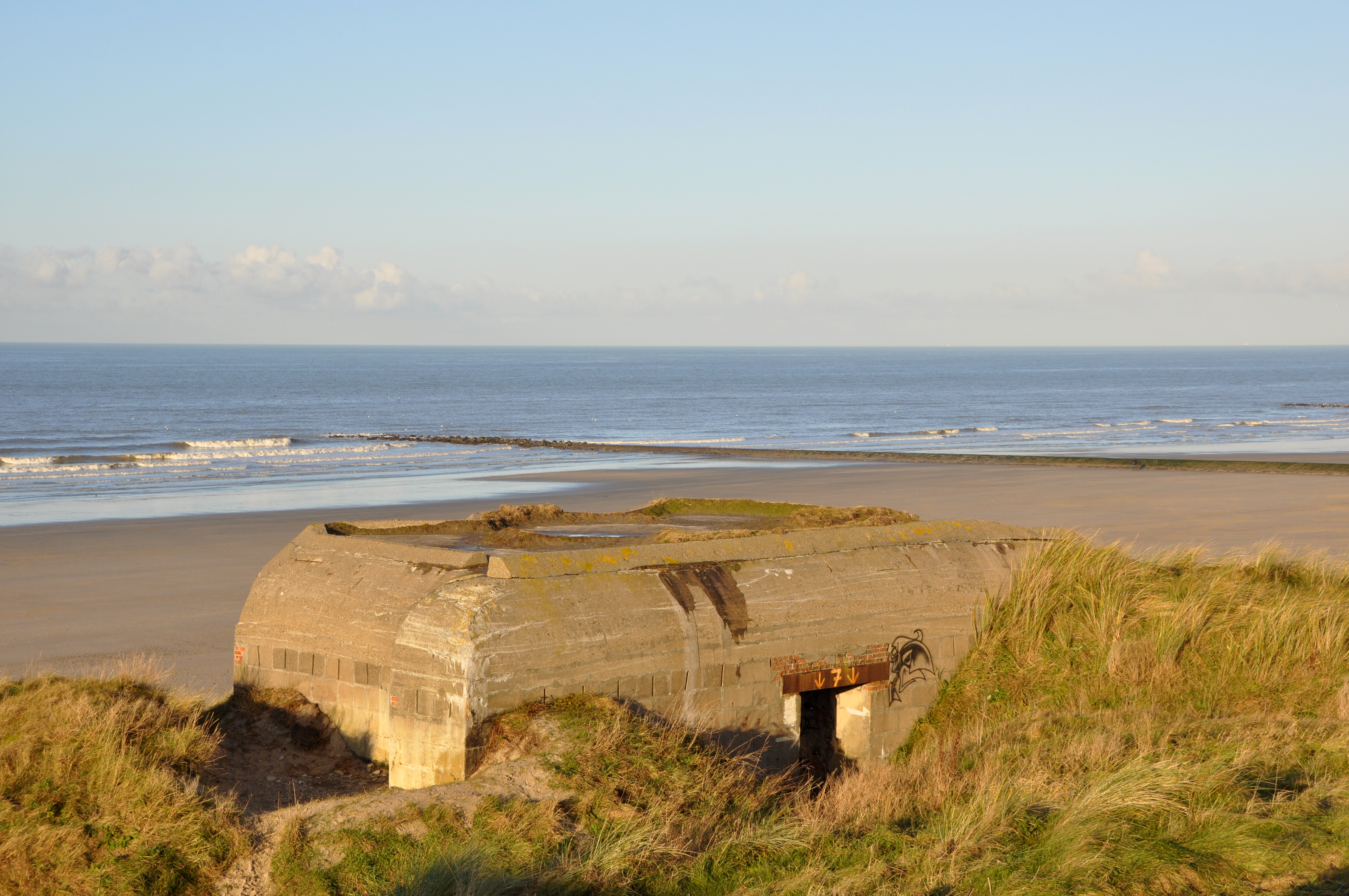
English: Ostend (Belgium): German pill-box from the Second World War; part of the Atlantikwall
Nederlands: Oostende (West-Vlaanderen, België): bunker van de Duitse kustbatterij 'Hundius' uit de Tweede Wereldoorlog, onderdeel van de Atlantikwall
Français : Ostende (Belgique): bunker ayant fait partie de l'Atlantikwall (défense côtière allemande de la seconde guerre mondiale) |
Date | |
Source | Own work |
Author | Marc Ryckaert (MJJR) |
Permission (Reusing this file) |
Please attribute the author/ Naamsvermelding vereist |
Camera location | 51° 14′ 19.14″ N, 2° 55′ 54.03″ E ![]() | View this and other nearby images on: OpenStreetMap | ![]() |
---|
Licensing
[edit]

- You are free:
- to share – to copy, distribute and transmit the work
- to remix – to adapt the work
- Under the following conditions:
- attribution – You must give appropriate credit, provide a link to the license, and indicate if changes were made. You may do so in any reasonable manner, but not in any way that suggests the licensor endorses you or your use.
File history
Click on a date/time to view the file as it appeared at that time.
Date/Time | Thumbnail | Dimensions | User | Comment | |
---|---|---|---|---|---|
current | 19:41, 9 December 2008 | ![]() | 4,288 × 2,848 (6.86 MB) | MJJR (talk | contribs) | {{Information |Description= {{en|Ostend (Belgium): German pill-box from the Second World War; part of the ''Atlantikwall''}} {{nl|Oostende (West-Vlaanderen, België): bunker van de Duitse kustbatterij 'Hundius' uit de Tweede Wereldoorlog, onderdeel van de |
You cannot overwrite this file.
File usage on Commons
The following 5 pages use this file:
File usage on other wikis
The following other wikis use this file:
- Usage on en.wikipedia.org
- Usage on fr.wikipedia.org
- Usage on pt.wikipedia.org
- Usage on ru.wikipedia.org
Metadata
This file contains additional information such as Exif metadata which may have been added by the digital camera, scanner, or software program used to create or digitize it. If the file has been modified from its original state, some details such as the timestamp may not fully reflect those of the original file. The timestamp is only as accurate as the clock in the camera, and it may be completely wrong.
Camera manufacturer | NIKON CORPORATION |
---|---|
Camera model | NIKON D90 |
Exposure time | 1/320 sec (0.003125) |
F-number | f/9 |
ISO speed rating | 200 |
Date and time of data generation | 15:13, 7 December 2008 |
Lens focal length | 42 mm |
Orientation | Normal |
Horizontal resolution | 300 dpi |
Vertical resolution | 300 dpi |
Software used | Adobe Photoshop 7.0 |
File change date and time | 20:28, 9 December 2008 |
Y and C positioning | Centered |
Exposure Program | Not defined |
Exif version | 2.21 |
Date and time of digitizing | 15:13, 7 December 2008 |
Meaning of each component |
|
APEX exposure bias | 0 |
Maximum land aperture | 4.3 APEX (f/4.44) |
Metering mode | Pattern |
Light source | Unknown |
Flash | Flash did not fire, auto mode |
DateTime subseconds | 00 |
DateTimeOriginal subseconds | 00 |
DateTimeDigitized subseconds | 00 |
Supported Flashpix version | 1 |
Color space | sRGB |
Sensing method | One-chip color area sensor |
File source | Digital still camera |
Scene type | A directly photographed image |
Custom image processing | Normal process |
Exposure mode | Auto exposure |
White balance | Auto white balance |
Digital zoom ratio | 1 |
Focal length in 35 mm film | 63 mm |
Scene capture type | Standard |
Scene control | None |
Contrast | Normal |
Saturation | Normal |
Sharpness | Normal |
Subject distance range | Unknown |
Structured data
Items portrayed in this file
depicts
7 December 2008
51°14'19.140"N, 2°55'54.030"E
0.003125 second
42 millimetre
200
image/jpeg
- Quality images
- Quality images missing SDC depicts
- Quality images missing SDC creator
- Files with coordinates missing SDC location of creation (51° N, 2° E)
- CC-BY-3.0
- Self-published work
- Taken with Nikon D90
- Images by MJJR
- Quality Images by MJJR
- Quality images of Belgium
- Belgium photographs taken on 2008-12-07
- Quality images of coasts
- Quality images of bunkers