File:2013-04-01 14-21-25-cascade.jpg

Original file (3,642 × 2,730 pixels, file size: 4.6 MB, MIME type: image/jpeg)
Captions
Captions
Summary
[edit]Description2013-04-01 14-21-25-cascade.jpg |
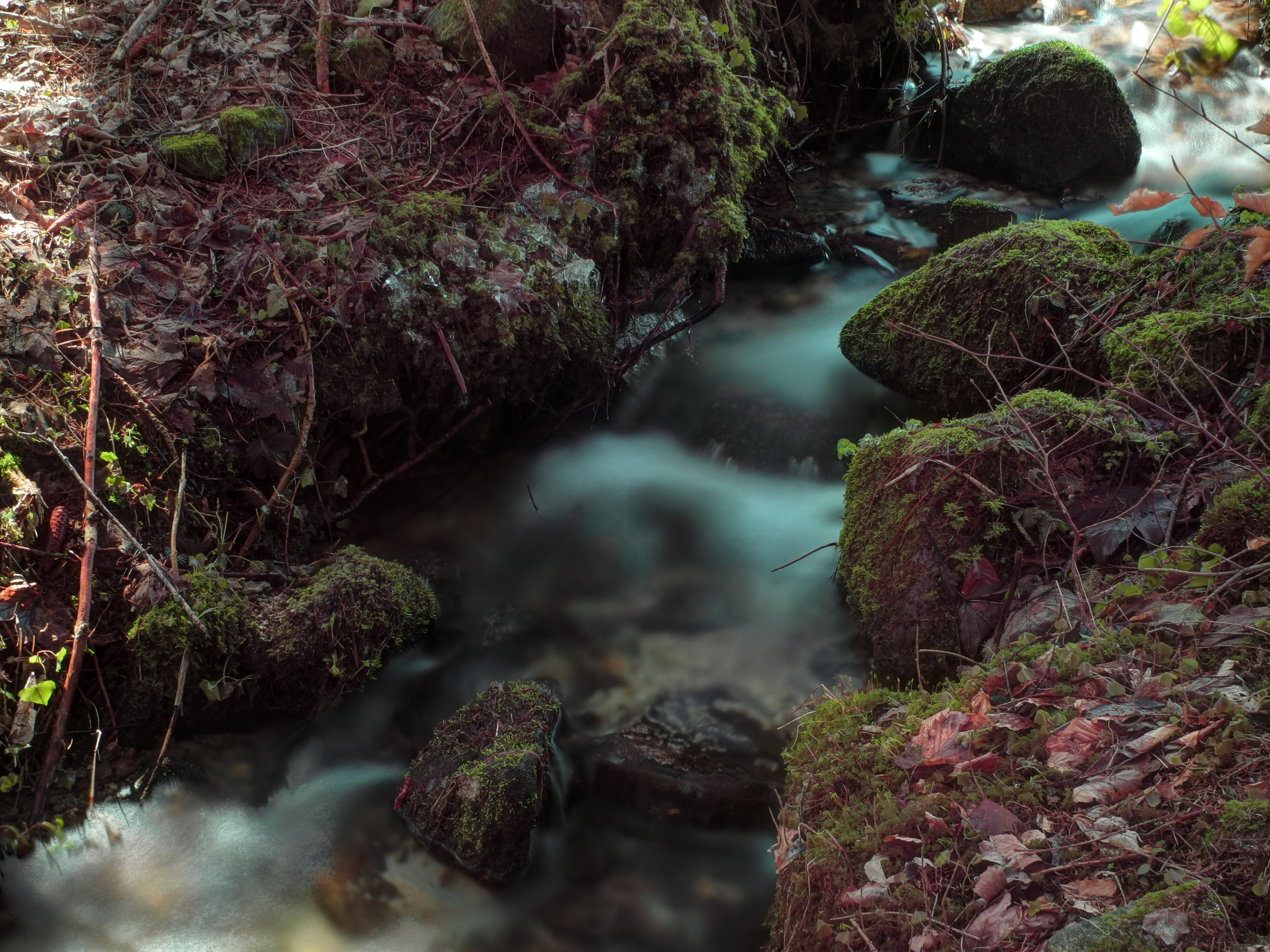
![]() This file was uploaded with Commonist. Français : Rigole à proximité de Falleurgoutte, Granges-sur-Vologne (Vosges, Lorraine, France) (HDR). Photo réalisée avec un filtre ND16 + filtre polarisant.
Català: Reguerot a prop del llogaret de Falleurgoutte, Granges-sur-Vologne (Vosges, Lorena, França) fotographia HDR amb un filtre ND16 i un altre polaritzant.
Español: Regueros cerca de la aldea de Falleurgoutte, Granges-sur-Vologne (Vosgos, Lorena, Francia) fotographia HDR con un filtro ND16 y otro polarizando.
English: Ditch near the hamlet of Falleurgoutte, Granges-sur-Vologne (Vosges, Lorraine, France) fotographia HDR with a polarizing filter and a ND16.
Português: Reguerot perto da aldeia de Falleurgoutte, Granges-sur-Vologne (Vosges, Lorraine, França) fotographia HDR com um filtro polarizador e uma ND16. |
||||||||||||||||||||||
Date | |||||||||||||||||||||||
Source | Own work | ||||||||||||||||||||||
Author |
|
Camera location | 48° 07′ 31.3″ N, 6° 47′ 12.53″ E ![]() | View this and other nearby images on: OpenStreetMap | ![]() |
---|
Licensing
[edit]

- You are free:
- to share – to copy, distribute and transmit the work
- to remix – to adapt the work
- Under the following conditions:
- attribution – You must give appropriate credit, provide a link to the license, and indicate if changes were made. You may do so in any reasonable manner, but not in any way that suggests the licensor endorses you or your use.
![]() |
This image has been assessed using the Quality image guidelines and is considered a Quality image.
العربية ∙ جازايرية ∙ беларуская ∙ беларуская (тарашкевіца) ∙ български ∙ বাংলা ∙ català ∙ čeština ∙ Cymraeg ∙ Deutsch ∙ Schweizer Hochdeutsch ∙ Zazaki ∙ Ελληνικά ∙ English ∙ Esperanto ∙ español ∙ eesti ∙ euskara ∙ فارسی ∙ suomi ∙ français ∙ galego ∙ עברית ∙ हिन्दी ∙ hrvatski ∙ magyar ∙ հայերեն ∙ Bahasa Indonesia ∙ italiano ∙ 日本語 ∙ Jawa ∙ ქართული ∙ Qaraqalpaqsha ∙ 한국어 ∙ kurdî ∙ кыргызча ∙ Latina ∙ Lëtzebuergesch ∙ lietuvių ∙ македонски ∙ മലയാളം ∙ मराठी ∙ Bahasa Melayu ∙ Nederlands ∙ Norfuk / Pitkern ∙ polski ∙ português ∙ português do Brasil ∙ rumantsch ∙ română ∙ русский ∙ sicilianu ∙ slovenčina ∙ slovenščina ∙ shqip ∙ српски / srpski ∙ svenska ∙ தமிழ் ∙ తెలుగు ∙ ไทย ∙ Tagalog ∙ toki pona ∙ Türkçe ∙ українська ∙ oʻzbekcha / ўзбекча ∙ vèneto ∙ Tiếng Việt ∙ 中文 ∙ 中文(简体) ∙ 中文(繁體) ∙ +/− |
File history
Click on a date/time to view the file as it appeared at that time.
Date/Time | Thumbnail | Dimensions | User | Comment | |
---|---|---|---|---|---|
current | 08:51, 2 April 2013 | ![]() | 3,642 × 2,730 (4.6 MB) | ComputerHotline (talk | contribs) |
You cannot overwrite this file.
File usage on Commons
The following 4 pages use this file:
Metadata
This file contains additional information such as Exif metadata which may have been added by the digital camera, scanner, or software program used to create or digitize it. If the file has been modified from its original state, some details such as the timestamp may not fully reflect those of the original file. The timestamp is only as accurate as the clock in the camera, and it may be completely wrong.
Camera manufacturer | NIKON |
---|---|
Camera model | COOLPIX P7100 |
Exposure time | 20/1 sec (20) |
F-number | f/6.3 |
ISO speed rating | 100 |
Date and time of data generation | 14:21, 1 April 2013 |
Lens focal length | 10.7 mm |
Latitude | 48° 7′ 31.29″ N |
Longitude | 6° 47′ 12.53″ E |
Altitude | 595 meters above sea level |
Image title |
|
Headline | Water |
City shown | Granges Sur Vologne |
Orientation | Normal |
Horizontal resolution | 300 dpi |
Vertical resolution | 300 dpi |
Software used | ViewNX 2.5 W |
File change date and time | 10:41, 2 April 2013 |
Y and C positioning | Centered |
Exposure Program | Manual |
Exif version | 2.3 |
Date and time of digitizing | 14:21, 1 April 2013 |
Meaning of each component |
|
Metering mode | Pattern |
Flash | Flash did not fire, compulsory flash suppression |
Supported Flashpix version | 1 |
Color space | sRGB |
Custom image processing | Normal process |
Exposure mode | Manual exposure |
White balance | Manual white balance |
Digital zoom ratio | 0 |
Focal length in 35 mm film | 50 mm |
Scene capture type | Standard |
Subject distance range | Unknown |
GPS time (atomic clock) | 14:21 |
Geodetic survey data used | WGS-84 |
GPS date | 1 April 2013 |
GPS tag version | 0.0.2.2 |
Keywords |
|
Code for country shown | FRA |
Sublocation of city shown | Falleurgoutte |
Country shown | France |
Province or state shown | Lorraine |
IIM version | 4 |
Structured data
Items portrayed in this file
depicts
1 April 2013
48°7'31.29467"N, 6°47'12.53375"E
image/jpeg
eb461d7fc55fbd198406184b6e55749856e53cc2
4,820,765 byte
2,730 pixel
3,642 pixel
20 second
6.3
10.7 millimetre
100
- Uploaded with Commonist
- Photos by ComputerHotline
- Files with coordinates missing SDC location of creation (48° N, 6° E)
- CC-BY-3.0
- Quality images
- Quality images missing SDC depicts
- Taken through Kood Circular Polarisation filters + Nikon Coolpix P7100
- Created with Photomatix
- Tone-mapped HDR images of France
- Quality images of streams
- Quality images of Vosges
- Quality images with long exposure
- Quality images of rivers in France
- Quality images of waterfalls