
File:Laguna El Suero, Sierra Nevada, Merida, Venezuela.jpg

Size of this preview: 800 × 355 pixels. Other resolutions: 320 × 142 pixels | 640 × 284 pixels | 1,024 × 454 pixels | 1,280 × 568 pixels | 4,509 × 2,000 pixels.
Original file (4,509 × 2,000 pixels, file size: 12.4 MB, MIME type: image/jpeg)
Captions
Captions
Add a one-line explanation of what this file represents
Summary
[edit]| Camera location | | View this and other nearby images on: OpenStreetMap |
|---|
| Description |
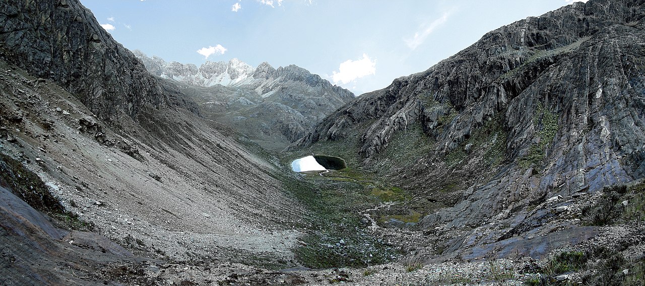
Español: Panoramica del Valle de Laguna El Suero, Sierra Nevada, Merida, Venezuela. La fotografia fue tomada desde una cornisa en la pared de piedra creada por la morrena del extinto glacial del pico Humboldt, a aproximadamente 200 metros del suelo mas alto del Valle ubicado a 4600 msnm |
|||
| Date | ||||
| Source | Own work | |||
| Author | Wilfredor | |||
| Permission (Reusing this file) |
|

|
NOTE: This image is a panorama consisting of multiple frames that were merged or stitched in software. As a result, this image necessarily underwent some form of digital manipulation. These manipulations may include blending, blurring, cloning, and colour and perspective adjustments. As a result of these adjustments, the image content may be slightly different from reality at the points where multiple images were combined. This manipulation is often required due to lens, perspective, and parallax distortions.
|
| Annotations | This image is annotated: View the annotations at Commons |

This image has been assessed using the Quality image guidelines and is considered a Quality image.
|

|
This image has been assessed under the valued image criteria and is considered the most valued image on Commons within the scope: Laguna El Suero. You can see its nomination here. |
File history
Click on a date/time to view the file as it appeared at that time.
| Date/Time | Thumbnail | Dimensions | User | Comment | |
|---|---|---|---|---|---|
| current | 18:05, 5 July 2012 | | 4,509 × 2,000 (12.4 MB) | Wilfredor (talk | contribs) |
You cannot overwrite this file.
File usage on Commons
The following 7 pages use this file:
- User:Wilfredor/Personal Gallery/Panoramas
- User talk:Wilfredor/Archive/2
- Commons:Quality images/Subject/Places/Natural structures/archive 2008 to 2012
- Commons:Quality images candidates/Archives July 2012
- Commons:Valued image candidates/Laguna El Suero, Sierra Nevada, Merida, Venezuela.jpg
- Commons:Valued images by topic/Places/Natural/Rivers and lakes
- Template:User:The Photographer/Personal Gallery
File usage on other wikis
The following other wikis use this file:
- Usage on ast.wikipedia.org
- Usage on en.wikipedia.org
- Usage on es.wikipedia.org