File:14-05-03-seifhennersdorf-RalfR-22 (cropped).jpg

Original file (4,912 × 4,912 pixels, file size: 8.67 MB, MIME type: image/jpeg)
Captions
Captions
Summary
[edit]Description14-05-03-seifhennersdorf-RalfR-22 (cropped).jpg |
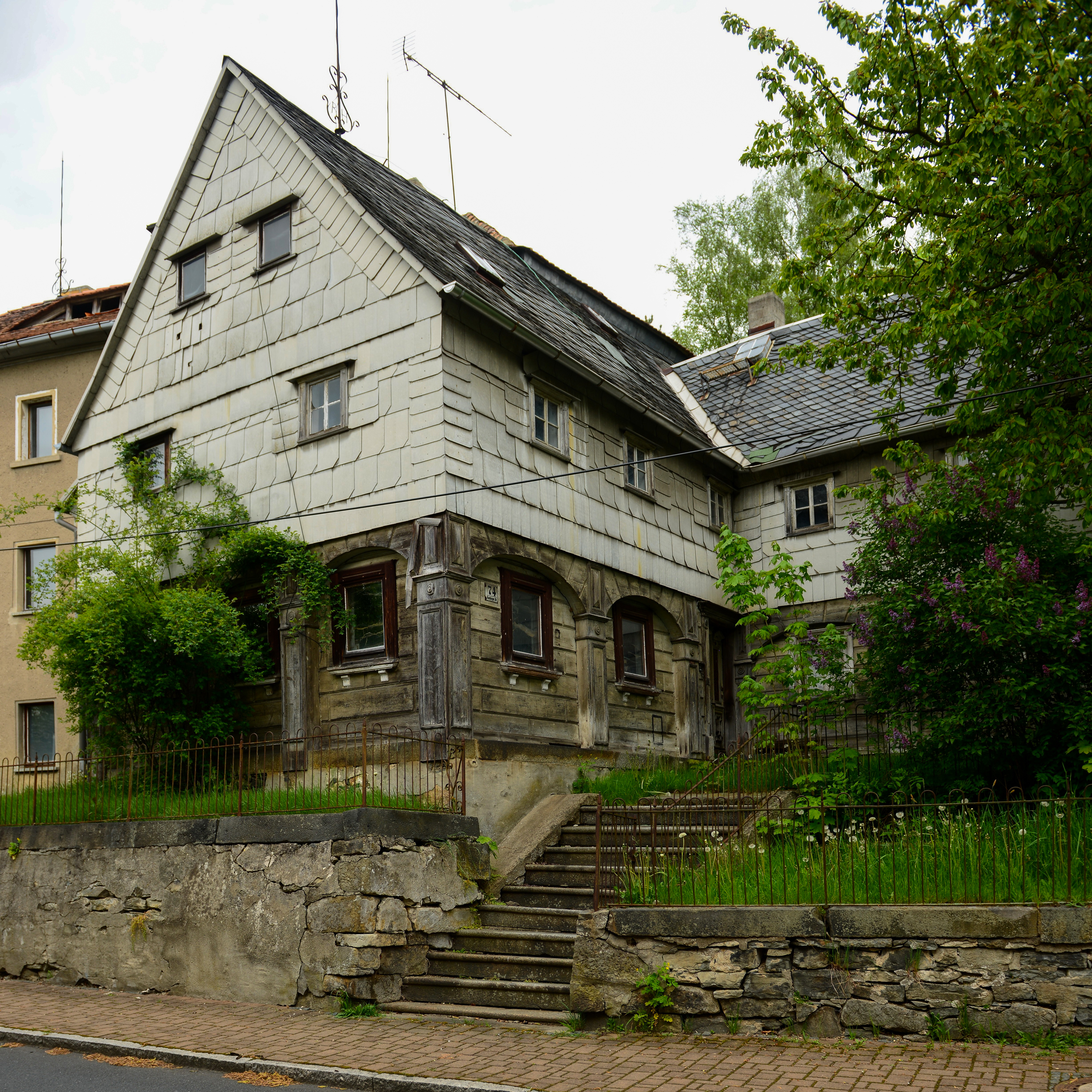
Deutsch: Umgebindehäuser in Seifhennersdorf, Rumburger Straße 74
|
|||||||||||||||||||||||
Date | ||||||||||||||||||||||||
Source | Own work | |||||||||||||||||||||||
Author |
creator QS:P170,Q15080600
|
|||||||||||||||||||||||
Permission (Reusing this file) |
creator QS:P170,Q15080600 |
Camera location | 50° 56′ 05.44″ N, 14° 36′ 35.43″ E ![]() ![]() | View this and other nearby images on: OpenStreetMap | ![]() |
---|
Object location | 50° 56′ 08.03″ N, 14° 36′ 03.77″ E ![]() | View this and other nearby images on: OpenStreetMap | ![]() |
---|
Licensing
[edit]![]() |
Permission is granted to copy, distribute and/or modify this document under the terms of the GNU Free Documentation License, Version 1.2 or any later version published by the Free Software Foundation; with no Invariant Sections, no Front-Cover Texts, and no Back-Cover Texts. A copy of the license is included in the section entitled GNU Free Documentation License.http://www.gnu.org/copyleft/fdl.htmlGFDLGNU Free Documentation Licensetruetrue |


- You are free:
- to share – to copy, distribute and transmit the work
- to remix – to adapt the work
- Under the following conditions:
- attribution – You must give appropriate credit, provide a link to the license, and indicate if changes were made. You may do so in any reasonable manner, but not in any way that suggests the licensor endorses you or your use.
- share alike – If you remix, transform, or build upon the material, you must distribute your contributions under the same or compatible license as the original.
![]() |
This file has been extracted from another file : 14-05-03-seifhennersdorf-RalfR-22.jpg |
![]() |
This image has been assessed using the Quality image guidelines and is considered a Quality image.
العربية ∙ جازايرية ∙ беларуская ∙ беларуская (тарашкевіца) ∙ български ∙ বাংলা ∙ català ∙ čeština ∙ Cymraeg ∙ Deutsch ∙ Schweizer Hochdeutsch ∙ Zazaki ∙ Ελληνικά ∙ English ∙ Esperanto ∙ español ∙ eesti ∙ euskara ∙ فارسی ∙ suomi ∙ français ∙ galego ∙ עברית ∙ हिन्दी ∙ hrvatski ∙ magyar ∙ հայերեն ∙ Bahasa Indonesia ∙ italiano ∙ 日本語 ∙ Jawa ∙ ქართული ∙ Qaraqalpaqsha ∙ 한국어 ∙ kurdî ∙ кыргызча ∙ Latina ∙ Lëtzebuergesch ∙ lietuvių ∙ македонски ∙ മലയാളം ∙ मराठी ∙ Bahasa Melayu ∙ Nederlands ∙ Norfuk / Pitkern ∙ polski ∙ português ∙ português do Brasil ∙ rumantsch ∙ română ∙ русский ∙ sicilianu ∙ slovenčina ∙ slovenščina ∙ shqip ∙ српски / srpski ∙ svenska ∙ தமிழ் ∙ తెలుగు ∙ ไทย ∙ Tagalog ∙ toki pona ∙ Türkçe ∙ українська ∙ oʻzbekcha / ўзбекча ∙ vèneto ∙ Tiếng Việt ∙ 中文 ∙ 中文(简体) ∙ 中文(繁體) ∙ +/− |
File history
Click on a date/time to view the file as it appeared at that time.
Date/Time | Thumbnail | Dimensions | User | Comment | |
---|---|---|---|---|---|
current | 17:00, 21 May 2015 | ![]() | 4,912 × 4,912 (8.67 MB) | Ralf Roletschek (talk | contribs) | beschnitten, Camera Raw |
08:44, 5 April 2015 | ![]() | 4,912 × 5,511 (6 MB) | Herzi Pinki (talk | contribs) | Cropped version of File:14-05-03-seifhennersdorf-RalfR-22.jpg using CropTool. |
You cannot overwrite this file.
File usage on Commons
The following 8 pages use this file:
- User:Nicolas Rück (WMDE)/Supported by Wikimedia Deutschland 2015/3
- User:WikiAnika/Umgebinde/2015/II
- User:WikiAnika/Umgebinde/2015 April 1-10
- User:WikiAnika/Umgebinde/2015 May 21-31
- User talk:Ralf Roletschek/Archive/2015
- Commons:Quality images/Subject/Architecture/Residential Buildings/Archive 2015
- Commons:Quality images candidates/Archives May 24 2015
- Category:Rumburger Straße 74 (Seifhennersdorf)
File usage on other wikis
The following other wikis use this file:
- Usage on de.wikipedia.org
- Usage on www.wikidata.org
Metadata
This file contains additional information such as Exif metadata which may have been added by the digital camera, scanner, or software program used to create or digitize it. If the file has been modified from its original state, some details such as the timestamp may not fully reflect those of the original file. The timestamp is only as accurate as the clock in the camera, and it may be completely wrong.
Camera manufacturer | NIKON CORPORATION |
---|---|
Camera model | NIKON D800 |
Exposure time | 1/60 sec (0.016666666666667) |
F-number | f/4 |
ISO speed rating | 100 |
Date and time of data generation | 18:12, 3 May 2014 |
Lens focal length | 24 mm |
Latitude | 50° 56′ 5.44″ N |
Longitude | 14° 36′ 35.43″ E |
Altitude | 377 meters above sea level |
Width | 4,912 px |
Height | 5,511 px |
Bits per component |
|
Pixel composition | RGB |
Orientation | Normal |
Number of components | 3 |
Horizontal resolution | 300 dpi |
Vertical resolution | 300 dpi |
Software used | Adobe Photoshop CC 2014 (Windows) |
File change date and time | 18:59, 21 May 2015 |
Y and C positioning | Centered |
Exposure Program | Normal program |
Exif version | 2.3 |
Date and time of digitizing | 18:12, 3 May 2014 |
Meaning of each component |
|
APEX shutter speed | 5.906891 |
APEX aperture | 4 |
APEX exposure bias | 0 |
Maximum land aperture | 2.9708536585366 APEX (f/2.8) |
Metering mode | Pattern |
Light source | Unknown |
Flash | Flash did not fire, compulsory flash suppression |
DateTime subseconds | 813 |
DateTimeOriginal subseconds | 60 |
DateTimeDigitized subseconds | 60 |
Supported Flashpix version | 1 |
Color space | sRGB |
Sensing method | One-chip color area sensor |
File source | Digital still camera |
Scene type | A directly photographed image |
Custom image processing | Normal process |
Exposure mode | Auto exposure |
White balance | Manual white balance |
Digital zoom ratio | 1 |
Focal length in 35 mm film | 24 mm |
Scene capture type | Landscape |
Scene control | None |
Contrast | Normal |
Saturation | Normal |
Sharpness | Normal |
Subject distance range | Unknown |
GPS time (atomic clock) | 16:12 |
Satellites used for measurement | 07 |
Reference for direction of image | Magnetic direction |
Direction of image | 2.11 |
Geodetic survey data used | WGS 84 |
GPS date | 3 May 2014 |
GPS tag version | 0.0.3.2 |
Serial number of camera | 6019585 |
Lens used | 24.0-70.0 mm f/2.8 |
Date metadata was last modified | 20:59, 21 May 2015 |
Unique ID of original document | 0A99D29F7B3CF1AC19BE82BA007E8FB3 |
Structured data
Items portrayed in this file
depicts
3 May 2014
50°56'8.034"N, 14°36'3.773"E
image/jpeg
6f0cd85c3d58d40617f592e3c880c0fedf9b5d4f
9,095,436 byte
4,912 pixel
4,912 pixel
0.0166666666666667 second
100
24 millimetre
50°56'5.442"N, 14°36'35.431"E
- Cultural heritage monuments in Saxony with known ID
- Wikipedians in Seifhennersdorf
- Supported by Wikimedia Deutschland
- Supported by Wikimedia Österreich in 2014
- Images by Ralf Roletschek/x
- Pages with local camera coordinates and missing SDC coordinates
- License migration redundant
- GFDL
- CC-BY-SA-3.0,2.5,2.0,1.0
- Self-published work
- Extracted images
- Quality images
- Quality images by Ralf Roletschek/Deutschland
- Quality images by Ralf Roletschek/WM-AT 2015
- Quality images from Wikipedians in Seifhennersdorf
- Quality images of cultural heritage monuments in Saxony
- Seifhennersdorf photographs taken on 2014-05-03