File:GMS Pontes-20200819-RM-164424.jpg

Original file (4,624 × 2,312 pixels, file size: 3.84 MB, MIME type: image/jpeg)
Captions
Captions
Summary
[edit]DescriptionGMS Pontes-20200819-RM-164424.jpg |
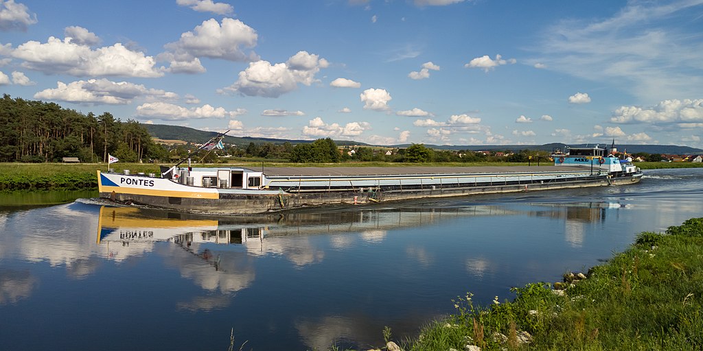
English: GMS Pontes in the MD-Canal between Hirschaid and Strullendorf
Deutsch: GMS Pontes im MD-Kanal zwischen Hirschaid und Strullendorf |
||||||
Date | |||||||
Source | Own work | ||||||
Author | Ermell | ||||||
Permission (Reusing this file) |
|
Camera location | 49° 49′ 19.93″ N, 10° 58′ 31.69″ E ![]() | View this and other nearby images on: OpenStreetMap | ![]() |
---|
Licensing
[edit]


- You are free:
- to share – to copy, distribute and transmit the work
- to remix – to adapt the work
- Under the following conditions:
- attribution – You must give appropriate credit, provide a link to the license, and indicate if changes were made. You may do so in any reasonable manner, but not in any way that suggests the licensor endorses you or your use.
- share alike – If you remix, transform, or build upon the material, you must distribute your contributions under the same or compatible license as the original.
![]() |
This image has been assessed using the Quality image guidelines and is considered a Quality image.
العربية ∙ جازايرية ∙ беларуская ∙ беларуская (тарашкевіца) ∙ български ∙ বাংলা ∙ català ∙ čeština ∙ Cymraeg ∙ Deutsch ∙ Schweizer Hochdeutsch ∙ Zazaki ∙ Ελληνικά ∙ English ∙ Esperanto ∙ español ∙ eesti ∙ euskara ∙ فارسی ∙ suomi ∙ français ∙ galego ∙ עברית ∙ हिन्दी ∙ hrvatski ∙ magyar ∙ հայերեն ∙ Bahasa Indonesia ∙ italiano ∙ 日本語 ∙ Jawa ∙ ქართული ∙ Qaraqalpaqsha ∙ 한국어 ∙ kurdî ∙ кыргызча ∙ Latina ∙ Lëtzebuergesch ∙ lietuvių ∙ македонски ∙ മലയാളം ∙ मराठी ∙ Bahasa Melayu ∙ Nederlands ∙ Norfuk / Pitkern ∙ polski ∙ português ∙ português do Brasil ∙ rumantsch ∙ română ∙ русский ∙ sicilianu ∙ slovenčina ∙ slovenščina ∙ shqip ∙ српски / srpski ∙ svenska ∙ தமிழ் ∙ తెలుగు ∙ ไทย ∙ Tagalog ∙ toki pona ∙ Türkçe ∙ українська ∙ oʻzbekcha / ўзбекча ∙ vèneto ∙ Tiếng Việt ∙ 中文 ∙ 中文(简体) ∙ 中文(繁體) ∙ +/− |
File history
Click on a date/time to view the file as it appeared at that time.
Date/Time | Thumbnail | Dimensions | User | Comment | |
---|---|---|---|---|---|
current | 21:44, 19 August 2020 | ![]() | 4,624 × 2,312 (3.84 MB) | Ermell (talk | contribs) | Uploaded with LrMediaWiki 0.8.0, LR 9.3 Win |
You cannot overwrite this file.
File usage on Commons
The following 3 pages use this file:
Metadata
This file contains additional information such as Exif metadata which may have been added by the digital camera, scanner, or software program used to create or digitize it. If the file has been modified from its original state, some details such as the timestamp may not fully reflect those of the original file. The timestamp is only as accurate as the clock in the camera, and it may be completely wrong.
Camera manufacturer | realme |
---|---|
Camera model | RMX2001 |
Copyright holder |
|
Exposure time | 1/2,200 sec (0.00045454545454545) |
F-number | f/1.8 |
ISO speed rating | 102 |
Date and time of data generation | 16:44, 19 August 2020 |
Lens focal length | 5.58 mm |
Latitude | 49° 49′ 19.93″ N |
Longitude | 10° 58′ 31.69″ E |
Author | reinhold möller |
City shown | Hirschaid |
Horizontal resolution | 240 dpi |
Vertical resolution | 240 dpi |
Software used | Adobe Photoshop Lightroom Classic 9.3 (Windows) |
File change date and time | 23:44, 19 August 2020 |
Exif version | 2.31 |
Date and time of digitizing | 16:44, 19 August 2020 |
APEX shutter speed | 11.103288 |
APEX aperture | 1.695994 |
DateTimeOriginal subseconds | 296 |
DateTimeDigitized subseconds | 296 |
Color space | sRGB |
GPS time (atomic clock) | 14:44 |
GPS date | 19 August 2020 |
GPS tag version | 0.0.3.2 |
Date metadata was last modified | 01:44, 20 August 2020 |
Unique ID of original document | xmp.did:be0043b8-540f-4eb7-b38d-4dc06045d6a0 |
Copyright status | Copyrighted |
Contact information |
|
Province or state shown | Bayern |
Country shown | Deutschland |
Code for country shown | DE |
IIM version | 4 |
Structured data
Items portrayed in this file
depicts
49°49'19.92997"N, 10°58'31.68995"E
19 August 2020
0.00045454545454545454 second
1.8
5.58 millimetre
102
image/jpeg
- Photographs by Ermell
- Files with coordinates missing SDC location of creation (49° N, 10° E)
- CC-BY-SA-4.0
- Self-published work
- Bavaria photographs taken on 2020-08-19
- Images by User:Ermell taken in 2020
- Taken with Olympus E-M1 Mark II
- Taken with Olympus M.Zuiko Digital ED 12-100mm f/4 PRO
- Quality images by Ermell
- Uploaded with LrMediaWiki
- Quality images of ships by Ermell
- Quality images of Bavaria
- Quality images