File:Ebing Mainverlegung .jpg

Original file (7,908 × 3,223 pixels, file size: 12.61 MB, MIME type: image/jpeg)
Captions
Captions
Summary
[edit]DescriptionEbing Mainverlegung .jpg |
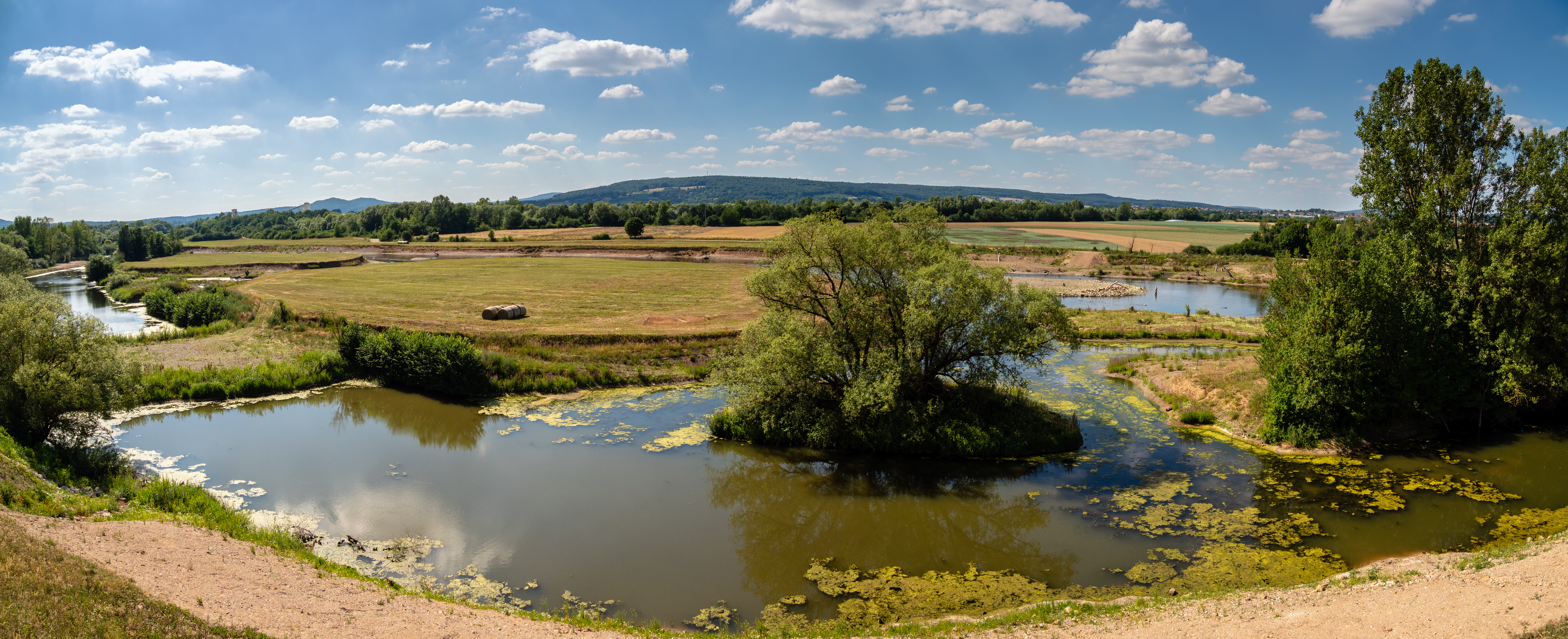
English: Renatured section of the Main river between Breitengüßbach and Ebing
Deutsch: Renaturierter Abschnitt des Main zwischen Breitengüßbach und Ebing |
||||||
Date | |||||||
Source | Own work | ||||||
Author | Ermell | ||||||
Permission (Reusing this file) |
|
Camera location | 49° 59′ 22.62″ N, 10° 54′ 14.55″ E ![]() | View this and other nearby images on: OpenStreetMap | ![]() |
---|
![]() |
This is a picture of the protected area listed at WDPA under the ID 555521172
|
![]() |
This image was uploaded as part of Wiki Loves Earth 2019.
aragonés | العربية | asturianu | azərbaycanca | беларуская (тарашкевіца) | български | বাংলা | brezhoneg | català | čeština | Cymraeg | Deutsch | Ελληνικά | English | español | eesti | euskara | فارسی | français | galego | עברית | hrvatski | հայերեն | Bahasa Indonesia | italiano | 日本語 | ქართული | 한국어 | latviešu | македонски | മലയാളം | मराठी | Bahasa Melayu | norsk bokmål | नेपाली | Nederlands | norsk | polski | português | português do Brasil | русский | sicilianu | shqip | slovenščina | српски / srpski | svenska | ไทย | Türkçe | українська | اردو | 中文 | 中文(台灣) | +/− |
![]() |
![]() |
NOTE: This image is a panorama consisting of multiple frames that were merged or stitched in software. As a result, this image necessarily underwent some form of digital manipulation. These manipulations may include blending, blurring, cloning, and colour and perspective adjustments. As a result of these adjustments, the image content may be slightly different from reality at the points where multiple images were combined. This manipulation is often required due to lens, perspective, and parallax distortions.
العربية ∙ Boarisch ∙ български ∙ dansk ∙ Deutsch ∙ Zazaki ∙ Ελληνικά ∙ English ∙ Canadian English ∙ British English ∙ Esperanto ∙ español ∙ eesti ∙ suomi ∙ français ∙ हिन्दी ∙ hrvatski ∙ magyar ∙ italiano ∙ 日本語 ∙ 한국어 ∙ македонски ∙ മലയാളം ∙ Nederlands ∙ polski ∙ português ∙ русский ∙ sicilianu ∙ slovenščina ∙ svenska ∙ Türkçe ∙ українська ∙ 中文 ∙ +/− |
Licensing
[edit]


- You are free:
- to share – to copy, distribute and transmit the work
- to remix – to adapt the work
- Under the following conditions:
- attribution – You must give appropriate credit, provide a link to the license, and indicate if changes were made. You may do so in any reasonable manner, but not in any way that suggests the licensor endorses you or your use.
- share alike – If you remix, transform, or build upon the material, you must distribute your contributions under the same or compatible license as the original.
Annotations InfoField | This image is annotated: View the annotations at Commons |
Altes Flußbett des Main, nach dem Bau der Schnellbahnstrecke teilweise verfüllt.
![]() |
This image has been assessed using the Quality image guidelines and is considered a Quality image.
العربية ∙ جازايرية ∙ беларуская ∙ беларуская (тарашкевіца) ∙ български ∙ বাংলা ∙ català ∙ čeština ∙ Cymraeg ∙ Deutsch ∙ Schweizer Hochdeutsch ∙ Zazaki ∙ Ελληνικά ∙ English ∙ Esperanto ∙ español ∙ eesti ∙ euskara ∙ فارسی ∙ suomi ∙ français ∙ galego ∙ עברית ∙ हिन्दी ∙ hrvatski ∙ magyar ∙ հայերեն ∙ Bahasa Indonesia ∙ italiano ∙ 日本語 ∙ Jawa ∙ ქართული ∙ Qaraqalpaqsha ∙ 한국어 ∙ kurdî ∙ кыргызча ∙ Latina ∙ Lëtzebuergesch ∙ lietuvių ∙ македонски ∙ മലയാളം ∙ मराठी ∙ Bahasa Melayu ∙ Nederlands ∙ Norfuk / Pitkern ∙ polski ∙ português ∙ português do Brasil ∙ rumantsch ∙ română ∙ русский ∙ sicilianu ∙ slovenčina ∙ slovenščina ∙ shqip ∙ српски / srpski ∙ svenska ∙ தமிழ் ∙ తెలుగు ∙ ไทย ∙ Tagalog ∙ toki pona ∙ Türkçe ∙ українська ∙ oʻzbekcha / ўзбекча ∙ vèneto ∙ Tiếng Việt ∙ 中文 ∙ 中文(简体) ∙ 中文(繁體) ∙ +/− |
File history
Click on a date/time to view the file as it appeared at that time.
Date/Time | Thumbnail | Dimensions | User | Comment | |
---|---|---|---|---|---|
current | 22:02, 23 May 2019 | ![]() | 7,908 × 3,223 (12.61 MB) | Ermell (talk | contribs) | Uploaded with LrMediaWiki 0.8.0, LR 8.3 Win |
You cannot overwrite this file.
File usage on Commons
The following 4 pages use this file:
File usage on other wikis
The following other wikis use this file:
- Usage on de.wikipedia.org
Metadata
This file contains additional information such as Exif metadata which may have been added by the digital camera, scanner, or software program used to create or digitize it. If the file has been modified from its original state, some details such as the timestamp may not fully reflect those of the original file. The timestamp is only as accurate as the clock in the camera, and it may be completely wrong.
Camera manufacturer | OLYMPUS CORPORATION |
---|---|
Camera model | E-M1MarkII |
Copyright holder | |
Exposure time | 1/640 sec (0.0015625) |
F-number | f/7.1 |
ISO speed rating | 200 |
Date and time of data generation | 16:08, 20 June 2018 |
Lens focal length | 12 mm |
Latitude | 49° 59′ 22.62″ N |
Longitude | 10° 54′ 14.55″ E |
Altitude | 304 meters above sea level |
Online copyright statement | https://creativecommons.org/licenses/by-sa/4.0/deed.de |
Author | reinhold möller |
Usage terms |
|
City shown | Breitengüßbach |
Horizontal resolution | 240 dpi |
Vertical resolution | 240 dpi |
Software used | Adobe Photoshop Lightroom Classic 8.3 (Windows) |
File change date and time | 00:02, 24 May 2019 |
Exposure Program | Aperture priority |
Exif version | 2.31 |
Date and time of digitizing | 16:08, 20 June 2018 |
APEX shutter speed | 9.321928 |
APEX aperture | 5.655638 |
APEX exposure bias | 0 |
Maximum land aperture | 4 APEX (f/4) |
Metering mode | Pattern |
Light source | Unknown |
Flash | Flash did not fire, compulsory flash firing |
DateTimeOriginal subseconds | 1 |
DateTimeDigitized subseconds | 1 |
Color space | sRGB |
Focal plane X resolution | 3,010.3623046875 |
Focal plane Y resolution | 3,010.3623046875 |
Focal plane resolution unit | 3 |
File source | Digital still camera |
Custom image processing | Normal process |
Exposure mode | Auto exposure |
White balance | Auto white balance |
Digital zoom ratio | 1 |
Focal length in 35 mm film | 24 mm |
Scene capture type | Standard |
Scene control | None |
Contrast | Normal |
Saturation | Normal |
Sharpness | Normal |
GPS tag version | 0.0.2.2 |
Serial number of camera | BHUA05919 |
Lens used | OLYMPUS M.12-100mm F4.0 |
Date metadata was last modified | 02:02, 24 May 2019 |
Unique ID of original document | 875FA04259FABD6D14E268FB7BF50393 |
Copyright status | Copyrighted |
Contact information |
|
Province or state shown | Bayern |
Country shown | Deutschland |
Code for country shown | DE |
IIM version | 4 |
Structured data
Items portrayed in this file
depicts
20 June 2018
49°59'22.61854"N, 10°54'14.55138"E
200
0.0015625 second
7.1
12 millimetre
image/jpeg
- Photographs by Ermell
- Files with coordinates missing SDC location of creation (49° N, 10° E)
- Protected areas with known WDPA-ID
- Images from Wiki Loves Earth 2019
- Images from Wiki Loves Earth 2019 in Germany
- Images from Wiki Loves Earth missing SDC depicts
- Images from Wiki Loves Earth missing SDC location of creation
- CC-BY-SA-4.0
- Self-published work
- Images with annotations
- Quality images
- Quality images missing SDC depicts
- Germany photographs taken on 2018-06-21
- Images from Wiki Loves Earth 2019, DE-BY
- Images by User:Ermell taken in 2018
- Taken with Olympus E-M1 Mark II
- Taken with Olympus M.Zuiko Digital ED 12-100mm f/4 PRO
- Quality images by Ermell
- Uploaded with LrMediaWiki
- Quality images of Upper Franconia by Ermell
- Quality images from Wiki Loves Earth 2019 in Germany